Michael_2000_rainfall.gif

Size of this preview:
800 × 596 pixels
.
Other resolutions:
320 × 238 pixels
|
640 × 476 pixels
|
1,024 × 762 pixels
|
1,280 × 953 pixels
|
1,475 × 1,098 pixels
.
Summary
Summary
| Description |
English:
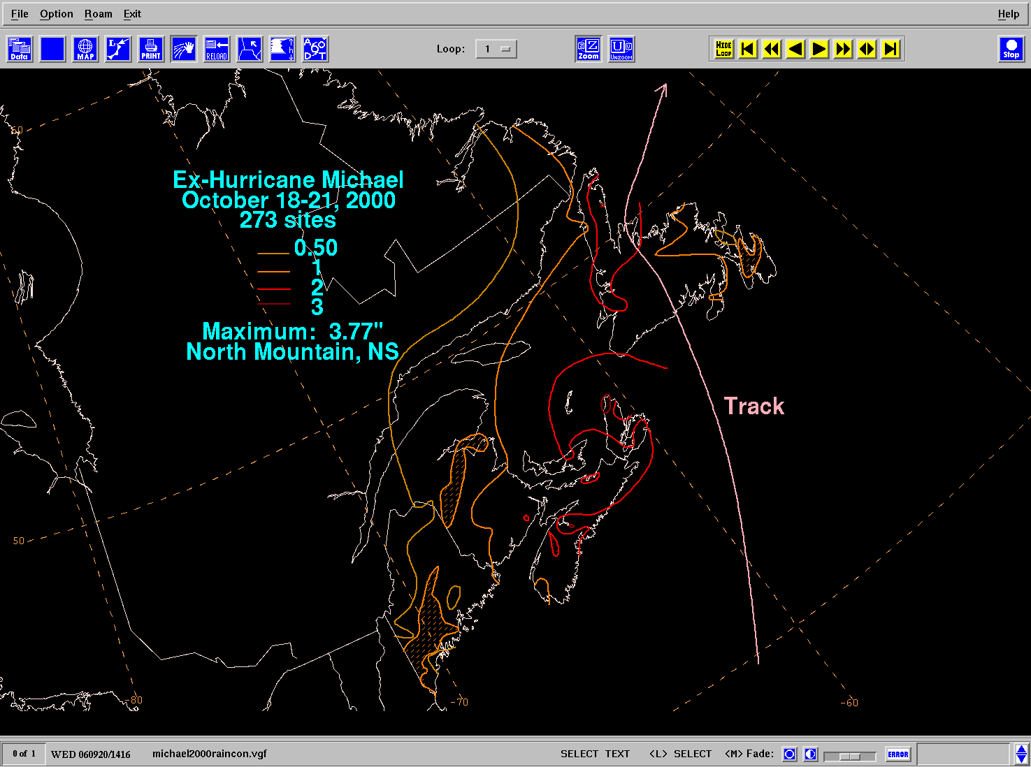
Storm total rainfall map of
Hurricane Michael
during October 2000.
Français :
Carte des accumulations de pluie associées avec l'ouragan Michael de la saison cyclonique 2000 dans l'Atlantique Nord.
|
|||
| Date | ||||
| Source | WPC tropical cyclone rainfall data | |||
| Author | David Roth , Weather Prediction Center , Camp Springs, Maryland | |||
|
Permission
( Reusing this file ) |
|
Derivative works of this file: Michael 2000 rainfall fr.png
Licensing
|
|
This image is in the
public domain
because it contains materials that originally came from the U.S.
National Oceanic and Atmospheric Administration
, taken or made as part of an employee's official duties.
|
|