Minoranze_linguistiche_it.svg

Size of this PNG preview of this SVG file:
471 × 600 pixels
.
Other resolutions:
188 × 240 pixels
|
377 × 480 pixels
|
603 × 768 pixels
|
804 × 1,024 pixels
|
1,608 × 2,048 pixels
|
4,022 × 5,122 pixels
.
Summary
| Description |
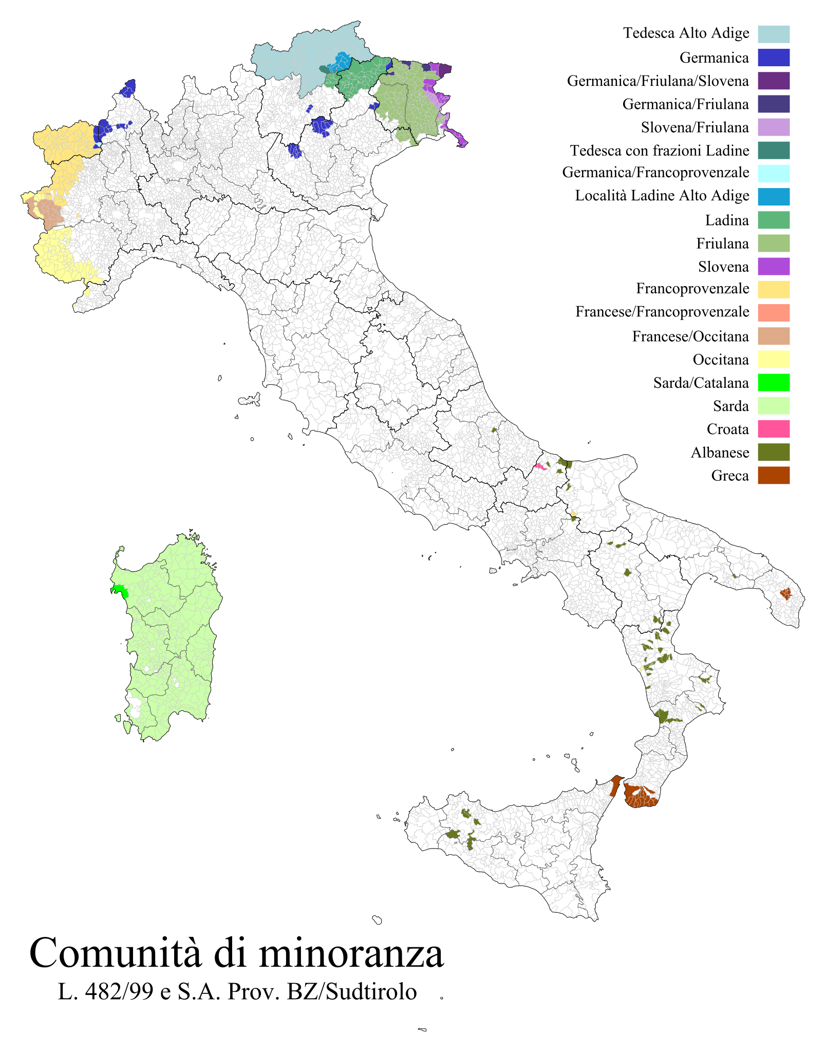
Italiano:
Mappa d'
Italia
. I dati cartografici provengono dall'
ISTAT
e sono aggiornati al 1º gennaio 2011; i dati sono reperibili in
questa pagina
. I dati delle comunità linguistiche provengono dal
Ministero dell'Istruzione
e sono aggiornati al 2013.
|
| Date | (UTC) |
| Source |
This file was derived from:
Regions, provinces and municipalities in Italy.svg
:

|
| Author |
|
- derivative work: Fulvio314
|
|
This is a
retouched picture
, which means that it has been digitally altered from its original version. Modifications:
Added minority language communities
. The original can be viewed here:
Regions, provinces and municipalities in Italy.svg
:
|
Licensing
I, the copyright holder of this work, hereby publish it under the following license:
This file is licensed under the
Creative Commons
Attribution 3.0 Unported
license.
-
You are free:
- to share – to copy, distribute and transmit the work
- to remix – to adapt the work
-
Under the following conditions:
- attribution – You must give appropriate credit, provide a link to the license, and indicate if changes were made. You may do so in any reasonable manner, but not in any way that suggests the licensor endorses you or your use.
Original upload log
This image is a derivative work of the following images:
- File:Regions,_provinces_and_municipalities_in_Italy.svg licensed with Cc-by-3.0
Uploaded with derivativeFX