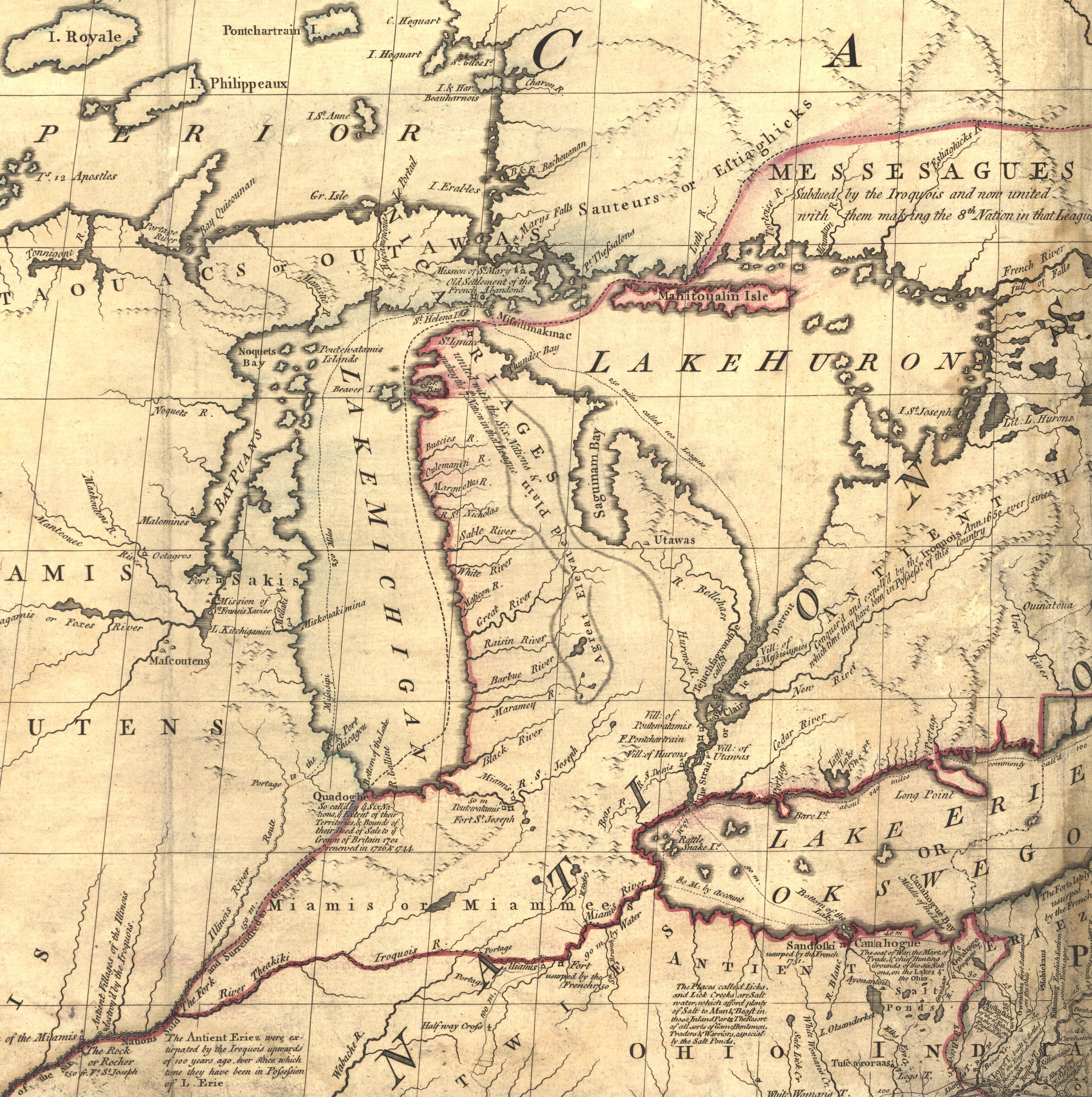
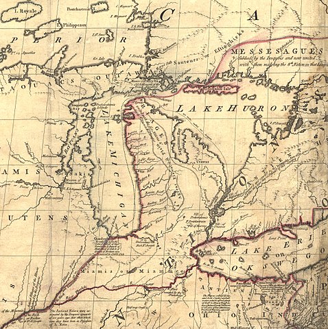
Mitchell_map_michigan.jpg
Size of this preview:
597 × 600 pixels
.
Other resolutions:
239 × 240 pixels
|
478 × 480 pixels
|
765 × 768 pixels
|
1,020 × 1,024 pixels
|
2,356 × 2,366 pixels
.
Summary
| Description | Mitchell Map - A map of the British and French dominions in North America,...; 1757, cropped to Michigan region |
| Date | between 1755 and 1757 |
| Source | Library of Congress |
| Author | John Mitchell; digital version, Library of Congress, Geography and Map Division. |
|
Permission
( Reusing this file ) |
"The Library of Congress is providing access to these materials for educational and research purposes and is not aware of any U.S. copyright protection" (source: http://memory.loc.gov/cgi-bin/ammemrr.pl?title=Map%20Collections&coll=gmd&div=&agg=g3300&default=ammem&dir=ammem ) |
| Other versions | Mitchell Map-06full2.jpg |
Licensing
|
This is a faithful photographic reproduction of a two-dimensional,
public domain
work of art. The work of art itself is in the public domain for the following reason:
The official position taken by the Wikimedia Foundation is that "
faithful reproductions of two-dimensional public domain works of art are public domain
".
This photographic reproduction is therefore also considered to be in the public domain in the United States. In other jurisdictions, re-use of this content may be restricted; see Reuse of PD-Art photographs for details. |
||||
Original upload log
The original description page was
here
. All following user names refer to en.wikipedia.
- 2006-05-03 00:35 Hotstreets 258×277×8 (28294 bytes) Mitchell Map of Michigan region from late 1700s. Public domain, since an image of a public domain image is also public domain. Found on [http://www.usm.maine.edu/~maps/mitchell/full2.jpeg].