MohaveCountyWaterDepth2006.PNG

Size of this preview:
614 × 600 pixels
.
Other resolutions:
246 × 240 pixels
|
492 × 480 pixels
|
786 × 768 pixels
|
1,024 × 1,000 pixels
.
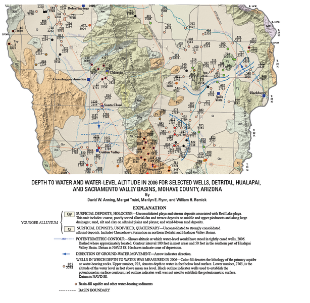
Summary
| Description |
English:
2006
w:United States Geological Survey
survey of the depth to water and water-level altitude in
w:Arizona
for selected wells.
|
| Date | |
| Source |
{{cite map|last=Anning|first=
David W.|publisher=[[:w:United States Geological Survey]]|title=Depth to water and water-level altitude in 2006 for selected wells, Detrital, Hualapai, and Sacramento Valley Basins, Mohave County, Arizona—Plate 1|url=http://pubs.usgs.gov/sir/2007/5182/plate/sir2007-5182_plate.pdf|edition=|year=2007|cartography=|scale=1:100,000|series=|page=|section=|inset=|accessdate=2008-12-22|isbn=|id=}}
|
| Author | David W. Anning as modified by -- Suntag ☼ |
Licensing
|
|
This image is in the
public domain
in the United States because it only contains materials that originally came from the
United States Geological Survey
, an agency of the
United States Department of the Interior
. For more information, see
the official USGS copyright policy
.
|
|