Mont_Blanc_massif_(west).jpg
Size of this preview:
800 × 600 pixels
.
Other resolutions:
320 × 240 pixels
|
640 × 480 pixels
|
1,024 × 768 pixels
|
1,280 × 960 pixels
|
2,560 × 1,920 pixels
|
3,000 × 2,250 pixels
.
Summary
| Description |
English:
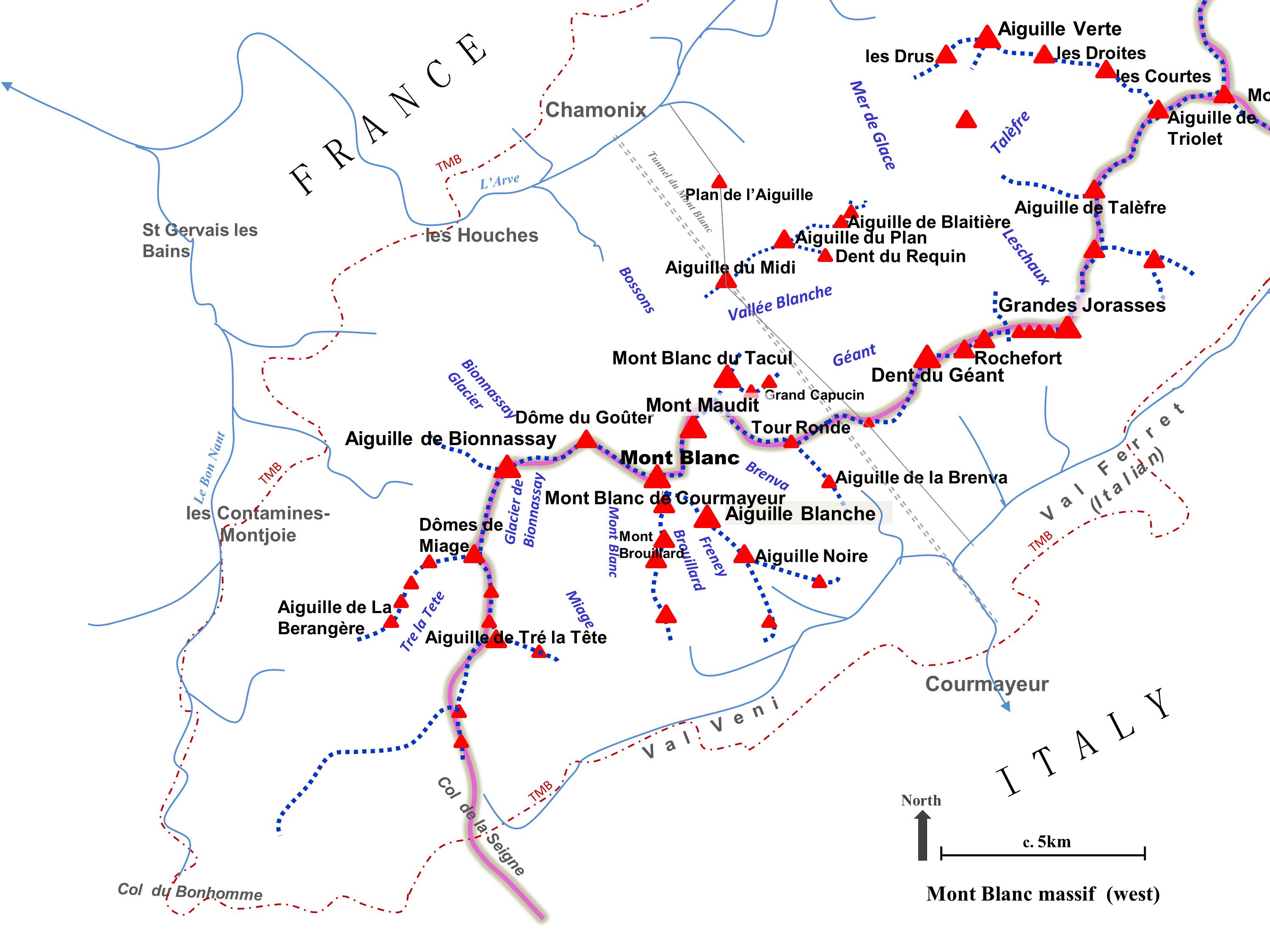
Main summits and ridges of the western half of the Mont Blanc massif.
The general position and direction of flow of some major glaciers and main rivers, plus the approximate route of the Tour du Mont Blanc (TMB), the Tunnel du Mont Blanc and the aerial cableway between Chamonix and Courmayeur, are also indicated. Boundary between France, Italy and Switzerland is shown in grey.
|
| Date | |
| Source | Own work |
| Author | Nick_Moyes |
|
Permission
( Reusing this file ) |
© OpenStreetMap contributors |
All features are indicative, based on rough tracing or comparison against OpenStreet Maps (© OpenStreetMap contributors) and to Wikimedia File: Chamonix and Mont-Blanc map 1892.jpg. Occasional reference to Bing aerial imagery for final error-checking.
Licensing
I, the copyright holder of this work, hereby publish it under the following license:
This file is licensed under the
Creative Commons
Attribution-Share Alike 4.0 International
license.
-
You are free:
- to share – to copy, distribute and transmit the work
- to remix – to adapt the work
-
Under the following conditions:
- attribution – You must give appropriate credit, provide a link to the license, and indicate if changes were made. You may do so in any reasonable manner, but not in any way that suggests the licensor endorses you or your use.
- share alike – If you remix, transform, or build upon the material, you must distribute your contributions under the same or compatible license as the original.