Moscow_Kremlin_map,_1760s.jpg
Size of this preview:
638 × 599 pixels
.
Other resolutions:
256 × 240 pixels
|
511 × 480 pixels
|
818 × 768 pixels
|
1,200 × 1,127 pixels
.
Summary
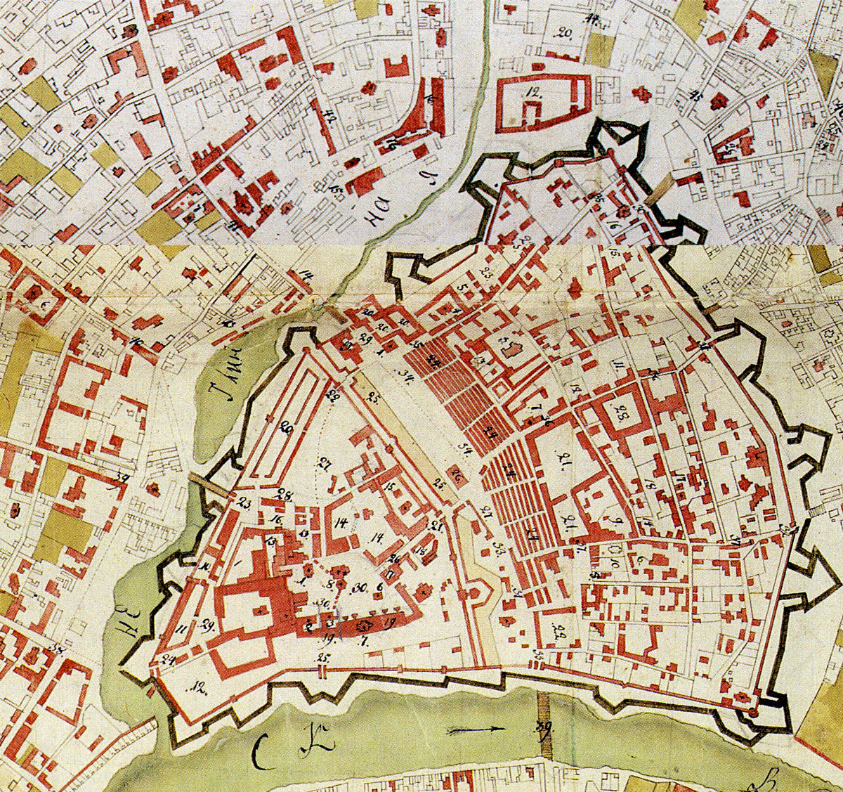
| Description | 1760s map of Moscow Kremlin, Kitai-gorod and Neglinnaya river valley that would later become Central Squares. |
| Date | between 1760 and 1768 |
| Source | Scan from Памятники архитектуры Москвы. Замоскворечье — М.: Искусство, 1994. ISBN 5-210-02548-9 |
| Author | State topographers, edited by Gorikhvostov |
|
Permission
( Reusing this file ) |
PD |
Licensing
|
|
This work is in the public domain in its country of origin and other countries and areas where the copyright term is the author's life plus 100 years or fewer . |
| This file has been identified as being free of known restrictions under copyright law, including all related and neighboring rights. | |