Mt_Kailash_sat.jpg

Size of this preview:
800 × 575 pixels
.
Other resolutions:
320 × 230 pixels
|
640 × 460 pixels
|
1,024 × 736 pixels
|
1,152 × 828 pixels
.
Summary
| Description |
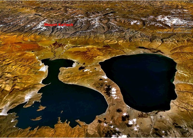
English:
Landsat7 Satellite view of the Mount Kailash, draped over SRTM DEM with
en:Lake Manasarovar
(right) and
en:Lake Rakshastal
(left) in the foreground. (Image made with the visualisation software NASA World Wind (Open Source))
Please move UP caption Mount Kailash Image:Mt Kailash sat.jpgPlease move UP caption Mount Kailash to enable mount kailash peak visible.Thanks. |
| Date | 1 May 2005 (original upload date) |
| Source | Transferred from en.wikipedia to Commons. |
| Author | The original uploader was Moumine at English Wikipedia . |
Licensing
|
|
This file is licensed under the Creative Commons Attribution-Share Alike 3.0 Unported license. Subject to disclaimers . | |
|
||
| This licensing tag was added to this file as part of the GFDL licensing update . |

|
Permission is granted to copy, distribute and/or modify this document under the terms of the GNU Free Documentation License , Version 1.2 or any later version published by the Free Software Foundation ; with no Invariant Sections, no Front-Cover Texts, and no Back-Cover Texts. A copy of the license is included in the section entitled GNU Free Documentation License . Subject to disclaimers . |
Original upload log
The original description page was
here
. All following user names refer to en.wikipedia.
- 2005-05-01 22:31 Moumine 1152×828×8 (667457 bytes) {{gfdl}} Landsat7 Satellite view of the Mount Kailash, draped over SRTM DEM with [[Lake Manasarowar]] (right) and [[Lake Rakshastal]] (left) in the foreground. (Image made with the visualisation software NASA World Wind (Open Source))