Mullet_Key_detail.png
No higher resolution available.
Summary
| Description |
English:
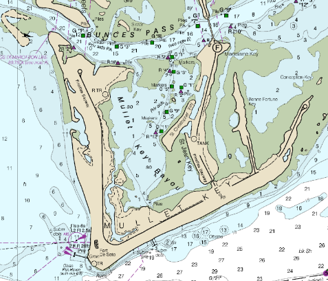
The chart shows the shape of Mullet Key, a barrier island. The image is of a part of the
File:Mullet Key chart.pdf
.
|
| Date | |
| Source |
https://www.charts.noaa.gov/BookletChart/11415_BookletChart.pdf Detail from BookletChart: Tampa Bay Entrance, NOAA Chart 11415 |
| Author | NOAA's Office of Coast Survey |
Licensing
|
|
This image is in the
public domain
because it contains materials that originally came from the U.S.
National Oceanic and Atmospheric Administration
, taken or made as part of an employee's official duties.
|
|