Muzzaffar_(Mogadishu_area)_flag_according_to_1576_Portuguese_map.svg

Size of this PNG preview of this SVG file:
800 × 332 pixels
.
Other resolutions:
320 × 133 pixels
|
640 × 265 pixels
|
1,024 × 424 pixels
|
1,280 × 530 pixels
|
2,560 × 1,061 pixels
|
1,163 × 482 pixels
.
Magalada kismaayo waa maagaalo darood
Ogaden ba is leh tarikhda hore ee sarinley marka dib lo eego ee magalada bardhere
Summary
| Description |
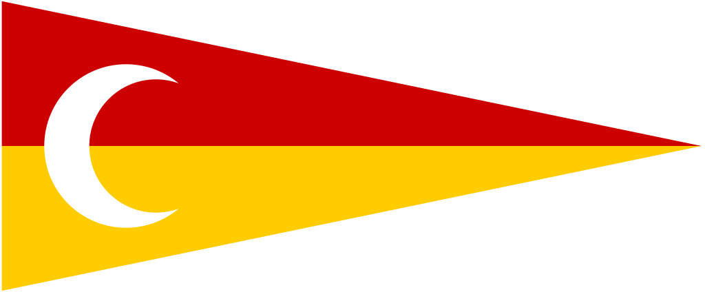
One interpretation of the flag shown next to the Mogadishu area on a 1576 map by Fernão Vaz Doura.
WARNING : This image is highly speculative and should not be added to articles about the Ajuran Sultanate. If it is added anyway, then its speculative nature must be a clearly indicated. |
| Date | (SVG file) |
| Source |
This is a loose vector equivalent (i.e. not a tracing) of image File:Muzzaffar flag.JPG by User:Scoobycentric , in turn partially based on the interpretations by Jorge Candeias of markings on an old map (see http://flagspot.net/flags/eaf-1576.html ). This image was converted from the following self-authored vector PostScript source code: %! .4 dup scale 0 0 moveto 1163 0 lineto 1163 482 lineto 0 482 lineto closepath stroke .8 0 0 setrgbcolor 3 241 moveto 3 480 lineto 1157 241 lineto closepath fill 1 .8 0 setrgbcolor 3 241 moveto 3 2 lineto 1157 241 lineto closepath fill 1 setgray 208 241 135 50 310 arc 257.291 241 110 289.924 70.076 arcn fill showpage %EOF |
| Author | AnonMoos (SVG file) |
Licensing
|
|
I, the copyright holder of this work, release this work into the
public domain
. This applies worldwide.
In some countries this may not be legally possible; if so: I grant anyone the right to use this work for any purpose , without any conditions, unless such conditions are required by law. |