Myanmar_states_location.svg

Size of this PNG preview of this SVG file:
285 × 599 pixels
.
Other resolutions:
114 × 240 pixels
|
228 × 480 pixels
|
365 × 768 pixels
|
487 × 1,024 pixels
|
975 × 2,048 pixels
|
1,200 × 2,520 pixels
.
Summary
| Description |
English:
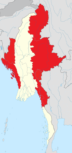
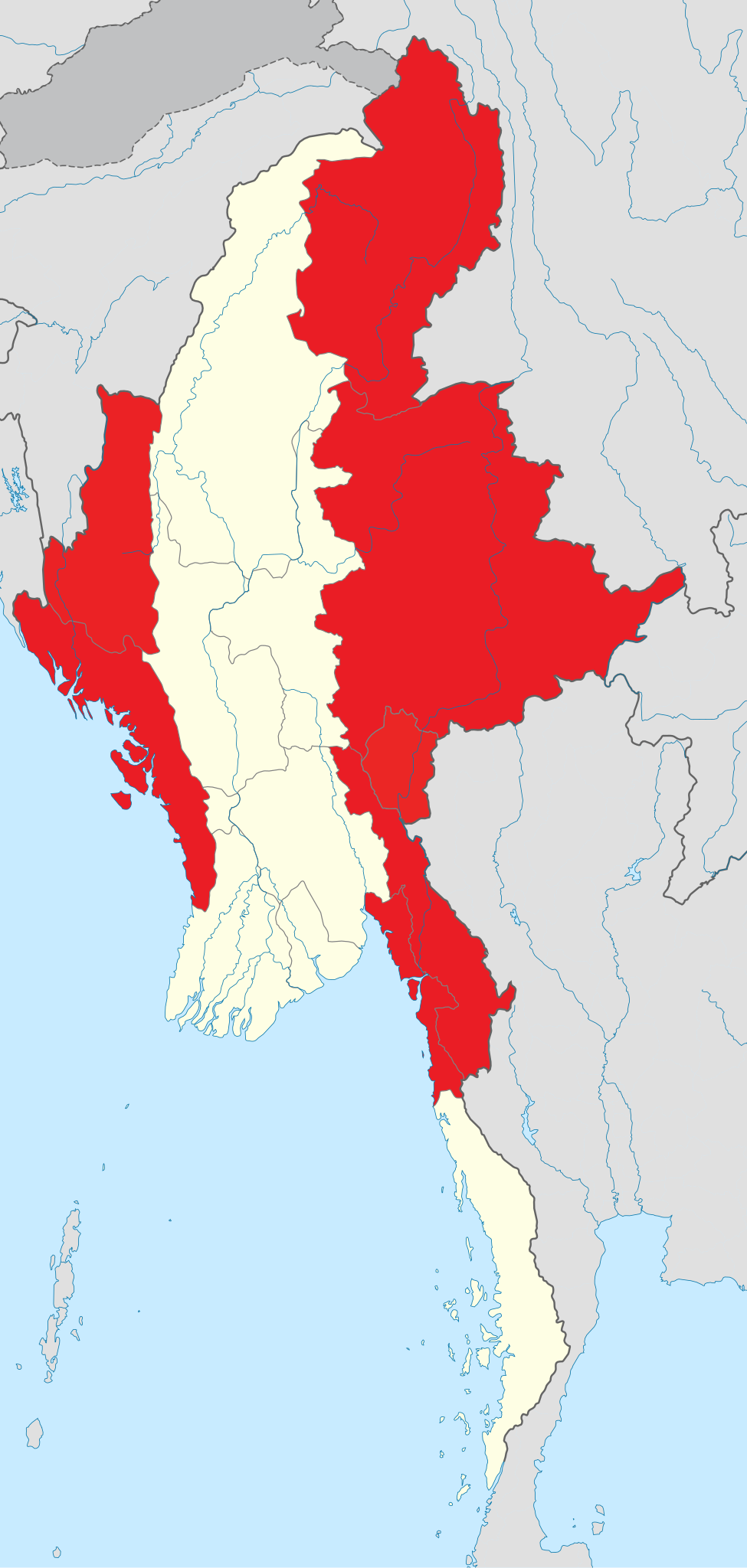
States of Myanmar are outlined in red. The regions can be described as ethnically predominantly Burman (Bamar), while the states, the zones and Wa Division are ethnic minority-dominant.
States (red);
Regions (white).
Français :
Les états du Myanmar sont affiché en rouge. Les régions peuvent être définies comme majoritairement peuplée par les Bamas, alors que les états, les zones et la division auto-administrée de Wa sont essentiellement peuplés d’ethnies minoritaires en Birmanie.
|
| Date | |
| Source | Own work , derived from File:Myanmar location map.svg and information from en:Administrative divisions of Burma . |
| Author | Quigley |
| Other versions |
This file was derived from:
Myanmar location map.svg
|
Licensing
I, the copyright holder of this work, hereby publish it under the following license:
This file is licensed under the
Creative Commons
Attribution-Share Alike 3.0 Unported
license.
-
You are free:
- to share – to copy, distribute and transmit the work
- to remix – to adapt the work
-
Under the following conditions:
- attribution – You must give appropriate credit, provide a link to the license, and indicate if changes were made. You may do so in any reasonable manner, but not in any way that suggests the licensor endorses you or your use.
- share alike – If you remix, transform, or build upon the material, you must distribute your contributions under the same or compatible license as the original.