NPS_pony-express-trail-map.pdf
Size of this JPG preview of this PDF file:
800 × 147 pixels
.
Other resolutions:
320 × 59 pixels
|
640 × 117 pixels
|
1,024 × 188 pixels
|
1,280 × 235 pixels
|
6,754 × 1,239 pixels
.
Summary
| Description |
English:
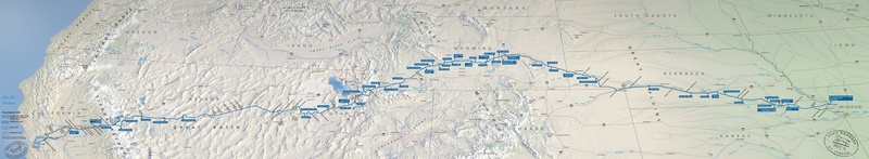
Pony Express map, a route protected today by the National Park Service as the Pony Express National Historic Trail. Mail could reach California from Missouri in ten days across eight states.
|
| Date | |
| Source | U.S. National Park Service ( http://npmaps.com/wp-content/uploads/pony-express-trail-map.pdf ) |
| Author | U.S. National Park Service, restoration/cleanup by Matt Holly |
| Other versions |

|
Licensing
|
|
This image or media file contains material based on a work of a National Park Service employee, created as part of that person's official duties. As a work of the U.S. federal government , such work is in the public domain in the United States. See the NPS website and NPS copyright policy for more information. |
|