NTSBSpuytenDuyvilDerailment2013.jpg
No higher resolution available.
Summary
| Description |
中文(简体):
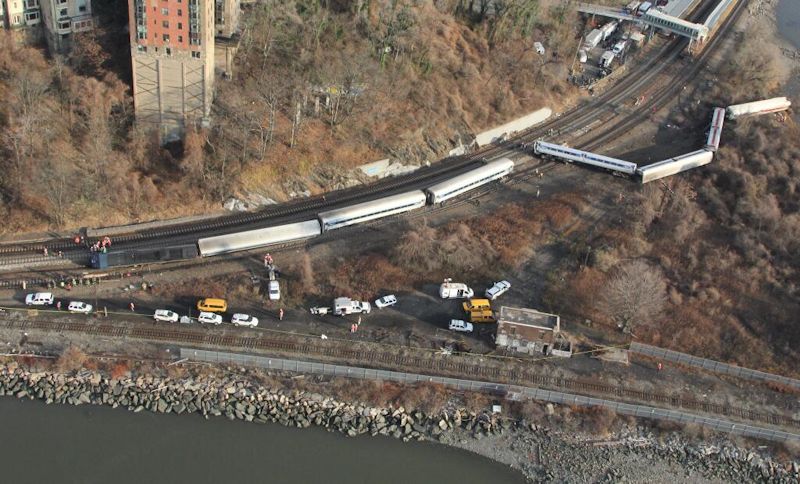
航拍
斯派滕戴维尔火车脱轨事故
现场
English:
Aerial view of the
December 2013 Spuyten Duyvil derailment
.
|
| Date | |
| Source | https://twitter.com/NTSB/status/407329136735027200/photo/1 |
| Author | National Transportation Safety Board |
| Camera location |
|
View this and other nearby images on: OpenStreetMap |
|
|---|
Licensing
|
|
This image is a work of a
National Transportation Safety Board
employee, taken or made as part of an employee's official duties. As a
work
of the
U.S. federal government
, all NTSB images are in the
public domain
in the United States.
|
|
Original upload log
The original description page was
here
. All following user names refer to en.wikipedia.
- 22:42, December 1, 2013 Twinbros22 2048×1536× (1345862 bytes) {{Information |Description = Aerial view of the December 2013 Spuyten Duyvil derailment. |Source = http://twitter.com/NTSB/status/407329136735027200/photo/ |Date = ~~~~~ |Author = NTSB |other_versions = }}