NUTS_1_statistical_regions_of_the_United_Kingdom_map.svg

Size of this PNG preview of this SVG file:
405 × 599 pixels
.
Other resolutions:
162 × 240 pixels
|
324 × 480 pixels
|
519 × 768 pixels
|
692 × 1,024 pixels
|
1,384 × 2,048 pixels
|
871 × 1,289 pixels
.
Summary
| Description |
English:
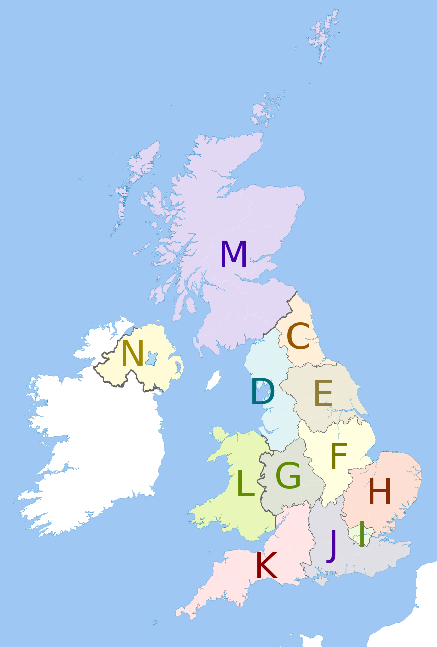
Map showing the
NUTS 1 statistical regions of the United Kingdom
in 2011.
Equirectangular map projection on WGS 84 datum, with N/S stretched 170% Geographic limits:
The region colours are paler versions of those in en:File:United Kingdom NUTS 1.png .
|
| Date | (UTC) |
| Source |
This file was derived from:
United Kingdom police areas map.svg
:

|
| Author |
|
|
|
This is a
retouched picture
, which means that it has been digitally altered from its original version. Modifications:
recoloured with some boundary lines hidden
. The original can be viewed here:
United Kingdom police areas map.svg
:
|
Licensing
I, the copyright holder of this work, hereby publish it under the following license:
This file is licensed under the
Creative Commons
Attribution-Share Alike 3.0 Unported
license.
Attribution:
Dr Greg and Nilfanion. Contains Ordnance Survey data © Crown copyright and database right 2011
-
You are free:
- to share – to copy, distribute and transmit the work
- to remix – to adapt the work
-
Under the following conditions:
- attribution – You must give appropriate credit, provide a link to the license, and indicate if changes were made. You may do so in any reasonable manner, but not in any way that suggests the licensor endorses you or your use.
- share alike – If you remix, transform, or build upon the material, you must distribute your contributions under the same or compatible license as the original.
Original upload log
This image is a derivative work of the following images:
-
File:United_Kingdom_police_areas_map.svg
licensed with Cc-by-sa-3.0
- 2011-10-12T11:33:39Z Nilfanion 871x1289 (2511111 Bytes) {{Information |Description=Map showing the [[w:Police areas|Police areas]] of the United Kingdom in 2011. Equirectangular map projection on WGS 84 datum, with N/S stretched 170% Geographic limits: *West: 11.0W *East: 2.2E *
Uploaded with derivativeFX