NW_Australia_1885.jpg

Size of this preview:
542 × 599 pixels
.
Other resolutions:
217 × 240 pixels
|
434 × 480 pixels
|
695 × 768 pixels
|
1,263 × 1,396 pixels
.
Summary
| Description |
English:
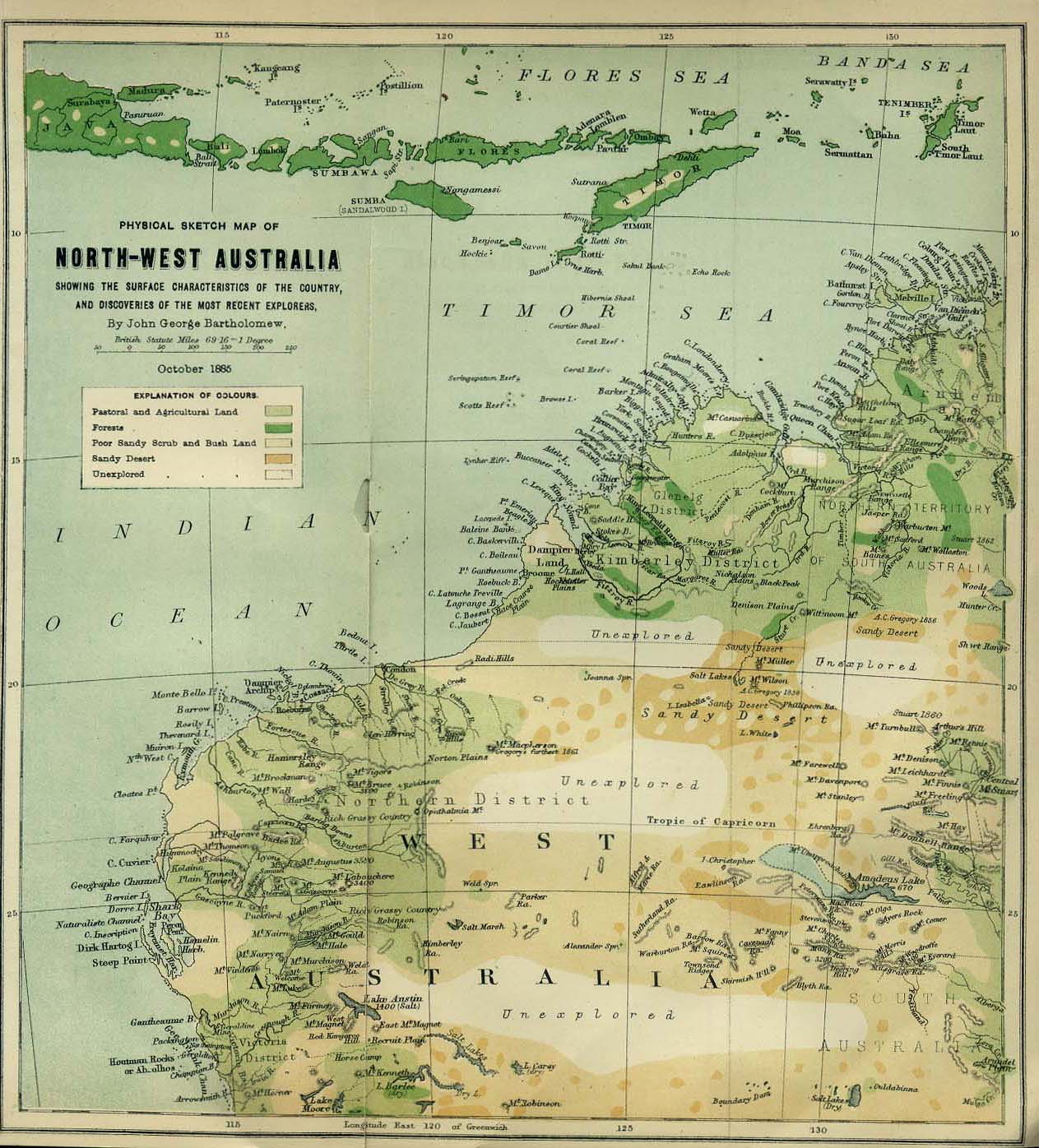
"Physical Sketch Map of Northwest Australia showing the surface characteristics of the country and discoveries of the most recent explorers." from the Scottish Geographical Magazine. Published by the Scottish Geographical Society and edited by Hugh A. Webster and Arthur Silva White. Volume I, 1885.
|
| Date | |
| Source | The University of Texas of Austin |
| Author | John George Bartholomew (1860-1920) |
Licensing
|
This is a faithful photographic reproduction of a two-dimensional,
public domain
work of art. The work of art itself is in the public domain for the following reason:
The official position taken by the Wikimedia Foundation is that "
faithful reproductions of two-dimensional public domain works of art are public domain
".
This photographic reproduction is therefore also considered to be in the public domain in the United States. In other jurisdictions, re-use of this content may be restricted; see Reuse of PD-Art photographs for details. |
||||