NYCS_map_M.svg

Size of this PNG preview of this SVG file:
490 × 599 pixels
.
Other resolutions:
196 × 240 pixels
|
393 × 480 pixels
|
628 × 768 pixels
|
838 × 1,024 pixels
|
1,676 × 2,048 pixels
|
648 × 792 pixels
.
Summary
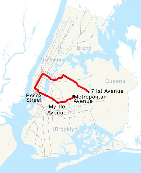
| Description | This is a map showing the New York City Subway's M service. It was created with TIGER/Line GIS data (water and boundaries) and my own data (subway lines and stations, traced on TIGER/Line road data). If you would like a copy of the subway data, email me . |
| Date | 27 April 2007 (original upload date) |
| Source | No machine-readable source provided. Own work assumed (based on copyright claims). |
| Author | No machine-readable author provided. NE2 assumed (based on copyright claims). |
Licensing
|
|
I, the copyright holder of this work, release this work into the
public domain
. This applies worldwide.
In some countries this may not be legally possible; if so: I grant anyone the right to use this work for any purpose , without any conditions, unless such conditions are required by law. |