NYP_LOC5.jpg
Size of this preview:
424 × 599 pixels
.
Other resolutions:
170 × 240 pixels
|
340 × 480 pixels
|
544 × 768 pixels
|
725 × 1,024 pixels
|
1,450 × 2,048 pixels
|
3,280 × 4,632 pixels
.
Summary
|
English: Pennsylvania Station, New York City (demolished 1963)
(
|
|||||||||||||||||||||||
|---|---|---|---|---|---|---|---|---|---|---|---|---|---|---|---|---|---|---|---|---|---|---|---|
| Author |
|
||||||||||||||||||||||
| Title |
English:
Pennsylvania Station
,
New York City (demolished 1963)
|
||||||||||||||||||||||
| Description |
English:
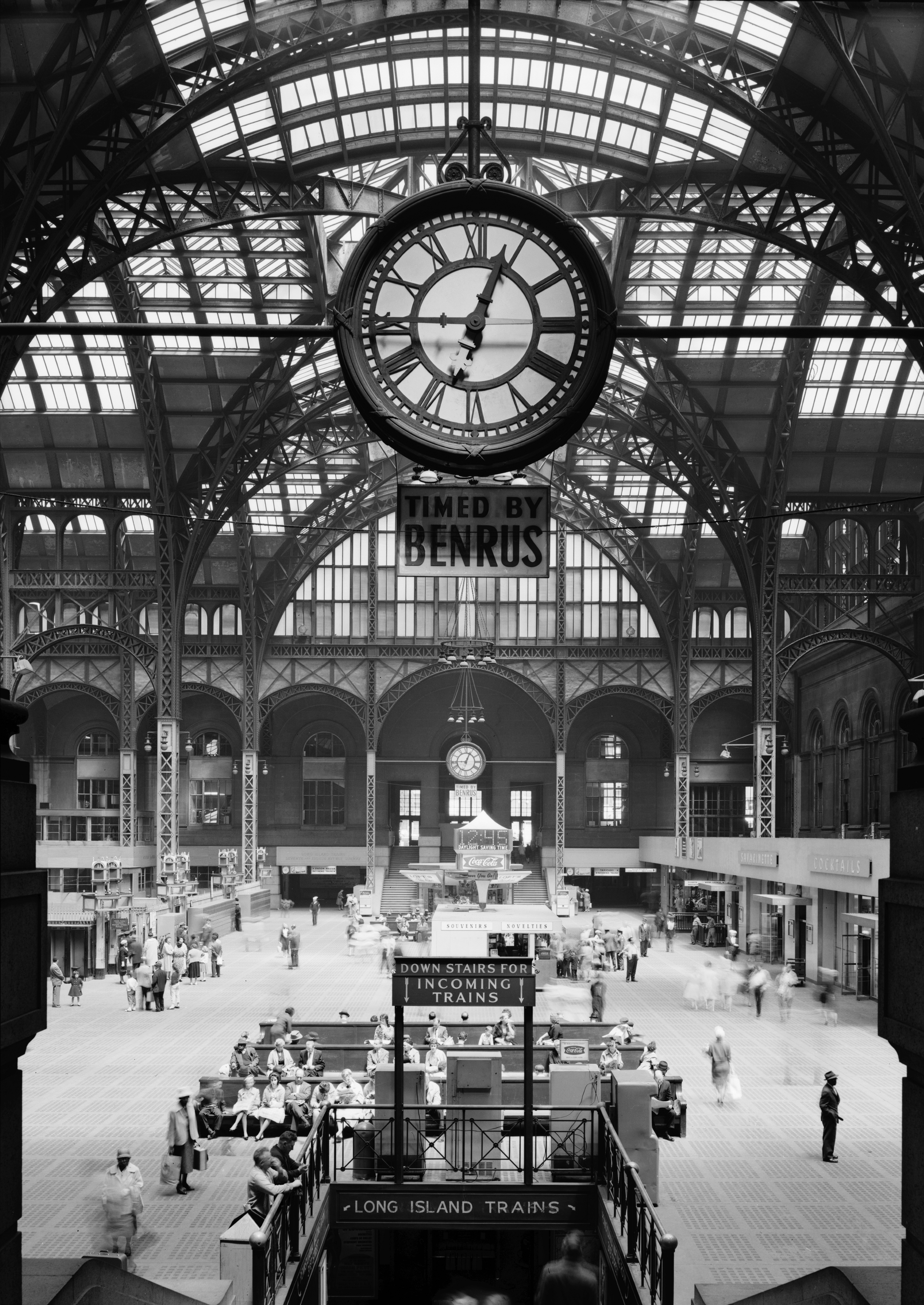
9. Historic American Buildings Survey, Cervin Robinson, Photographer April 24, 1962, CONCOURSE FROM SOUTH. - Pennsylvania Station, 370 Seventh Avenue, West Thirty-first, Thirty-first-Thirty-third Streets, New York, New York County, NY
|
||||||||||||||||||||||
| Date | 24 April 1962 | ||||||||||||||||||||||
| Source |
|
||||||||||||||||||||||
|
Permission
( Reusing this file ) |
HABS | ||||||||||||||||||||||
| Other versions |
|
||||||||||||||||||||||


| Camera location |
|
View this and other nearby images on: OpenStreetMap |
|
|---|
Licensing

|
This file comes from the
Historic American Buildings Survey (HABS), Historic American Engineering Record (HAER) or Historic American Landscapes Survey (HALS)
. These are programs of the National Park Service established for the purpose of documenting historic places. Records consist of measured drawings, archival photographs, and written reports.
|
|
|
This image or media file contains material based on a work of a National Park Service employee, created as part of that person's official duties. As a work of the U.S. federal government , such work is in the public domain in the United States. See the NPS website and NPS copyright policy for more information. |
|