NZ_North_Island_Robin-3.jpg
Size of this preview:
799 × 599 pixels
.
Other resolutions:
320 × 240 pixels
|
640 × 480 pixels
|
1,024 × 768 pixels
|
1,280 × 960 pixels
|
2,178 × 1,634 pixels
.
|

|
|
This image has been assessed using the
Quality image guidelines
and is considered a
Quality image
.
|
|
|
This image was selected as
picture of the day
on Wikimedia Commons for
24 July 2007
. It was captioned as follows:
English:
Toutouwai (North Island Robin,
Petroica australis longipes
), New Zealand
Other languages:
Čeština
:
Novozélandský
drobný pták
Toutouwai
Petroica australis longipes
English
:
Toutouwai (North Island Robin,
Petroica australis longipes
), New Zealand
Français
:
Miro rubisole
(
Petroica australis longipes
, nom maori :
Toutouwai
) de l'île du Nord de Nouvelle-Zélande. Cet oiseau a été bagué dans le cadre d'un programme de réintroduction de l'espèce à Wellington. Photo prise dans le
sanctuaire animalier de Karori
, une zone protégée des prédateurs par une barrière dont le reflet est visible dans l'œil de l'oiseau.
Italiano
:
Esemplare di
Petroica australis longipes
,
Nuova Zelanda
.
Nederlands
:
Noordereilandvliegenvanger (
Petroica australis
longipes
) op het
Noordereiland
van
Nieuw-Zeeland
Русский
:
Окольцованная новозеландская
малиновка
(
Petroica australis longipes
).
日本語
:
ニュージーランドロビン (
Petroica australis longipes
)
|
Summary
| Description |
Petroica longipes
English:
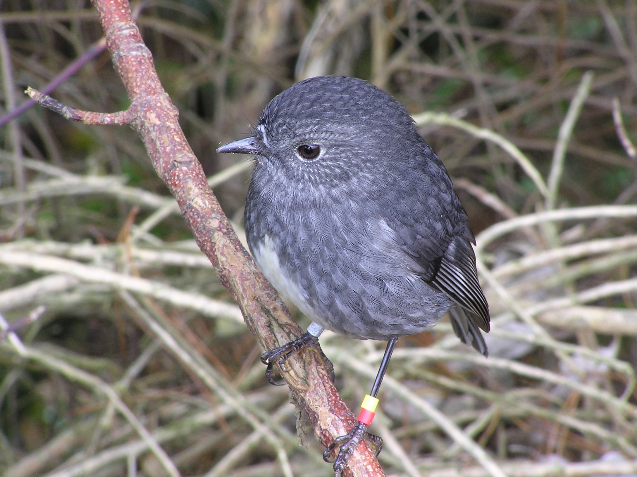
New Zealand North Island Robin (Māori name: Toutouwai). This bird is banded to identify it as part of a restoration scheme to return robins to Wellington and was released in the
Karori Wildlife Sanctuary
, an area surrounded by a predator proof fence. The fence can be seen reflected in its eyeball.
Français :
Miro rubisole
(nom maori :
Toutouwai
) de l'île du Nord de Nouvelle-Zélande. Cet oiseau a été bagué dans le cadre d'un programme de réintroduction de l'espèce à Wellington. Photo prise dans le
sanctuaire animalier de Karori
, une zone protégée des prédateurs par une barrière dont le reflet est visible dans l'œil de l'oiseau.
Māori:
He Toutouwai (Ingoa Pākehā: North Island Robin). Nā tētahi kaupapa whakahoki i ngā Toutouwai ki Te Whanga-nui-a-Tara ngā tarawhiti i whakamau ki ngā waewae. I wetekina ki te
Karori Wildlife Sanctuary
, he wāhi tiakina e te taiepa ārai konihi. I te karu o te manu nei te whakaata o taua taiepa.
|
||
| Date | |||
| Source | Own work | ||
| Author | Tony Wills | ||
|
Permission
( Reusing this file ) |
I,
Tony Wills
, the copyright holder of this work, hereby publishes it under the following licenses:
This file is licensed under the
Creative Commons
Attribution 2.5 Generic
license.
Attribution:
I,
Tony Wills
This file is licensed under the
Creative Commons
Attribution-Share Alike 3.0 Unported
license.
Attribution:
I,
Tony Wills
You may select the license of your choice.
|

| Camera location |
|
View this and other nearby images on: OpenStreetMap |
|
|---|
This image has been categorised by project WikiProject Birds