Newmarket_RD_1934.png
Size of this preview:
702 × 600 pixels
.
Other resolutions:
281 × 240 pixels
|
562 × 480 pixels
|
899 × 768 pixels
|
1,199 × 1,024 pixels
|
1,665 × 1,422 pixels
.
| Description |
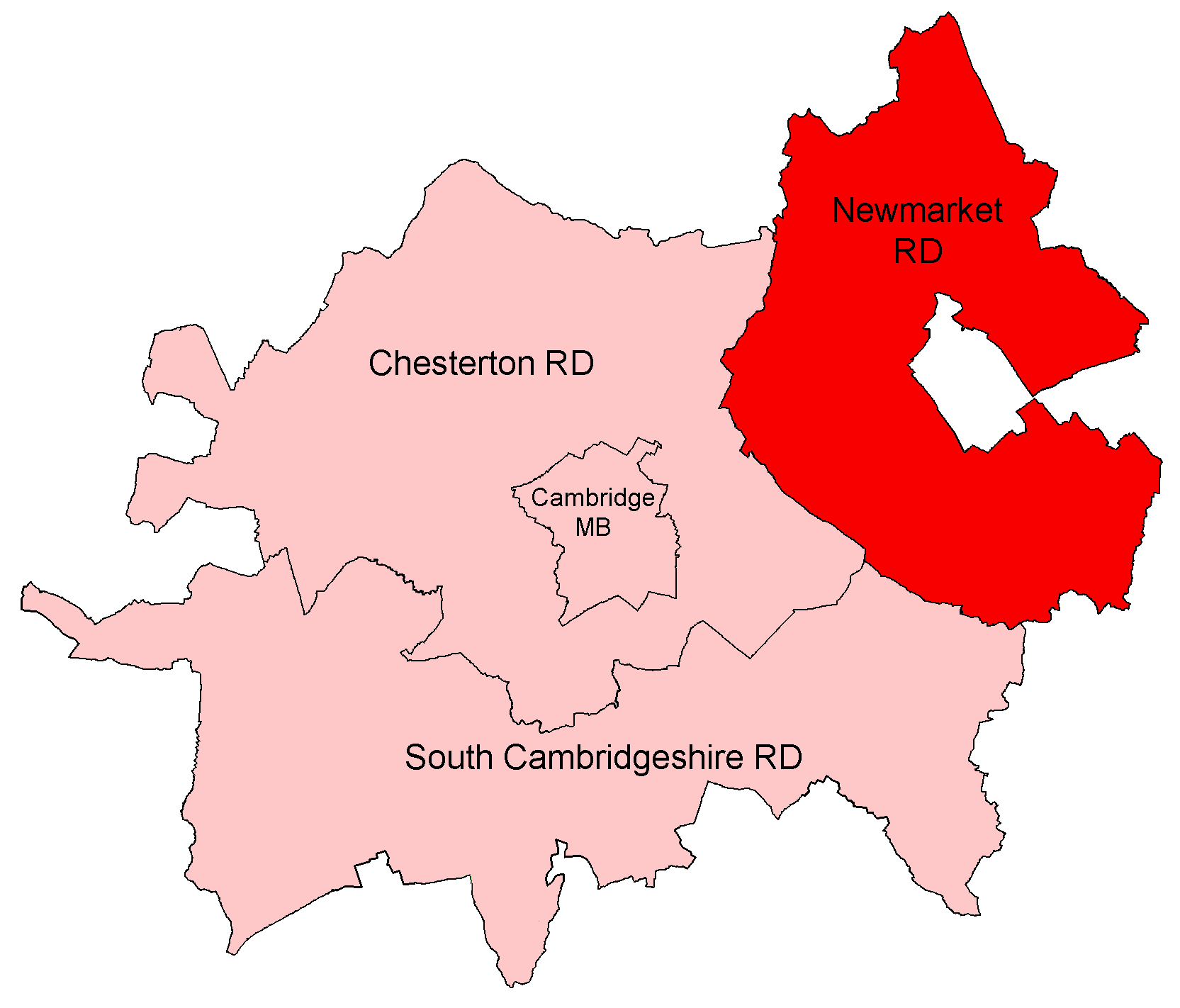
English:
Newmarket Rural District, shown within the administrative county of Cambridgeshire.
All boundaries shown are correct for the period between 1934 and 1965. Newmarket RD itself remained unchanged until abolition in 1974. |
| Date | |
| Source |
Districts built up from parishes as cited at w:Civil parishes in Cambridgeshire . Modern parish boundaries from Ordnance Survey Boundary-Line datasets licensed under the Open Government Licence v1.0. Historic boundaries, where different, from copyright-expired Provisional/First Edition 1:25,000. |
| Author | Keith Edkins |
|
Permission
( Reusing this file ) |
This file is licensed under the
Creative Commons
Attribution-Share Alike 4.0 International
license.
|