Nordkapp_map.png
Size of this preview:
800 × 509 pixels
.
Other resolutions:
320 × 204 pixels
|
640 × 408 pixels
|
837 × 533 pixels
.
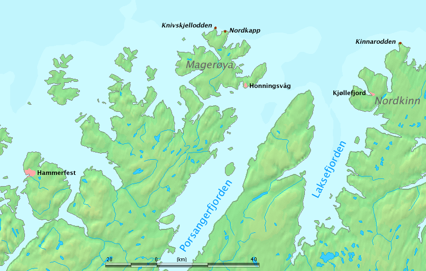
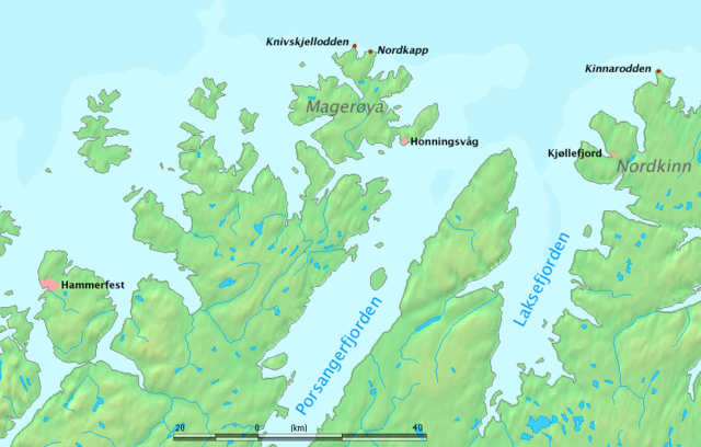
Map of North Cape region, Norway.
The map shows Nordkapp , Kinnarodden (northernmost point of mainland Europe, located on Nordkinn peninsula) and Knivskjellodden (northernmost point of Europe, located on the island of Magerøya).
Work by Markus Bernet , background map courtesy of www.demis.nl [ dead link ] .
|
|
This image is in the
public domain
because it came from the site
https://www.demis.nl/products/web-map-server/examples/
and was released by the
copyright
holder. Permission is granted to copy, distribute and/or modify this map since it is based on free of copyright images from:
www.demis.nl
. See also
approval email on de.wp
and
its clarification
.
|
|
|
This work has been released into the
public domain
by its
copyright
holder,
www.demis.nl
. This applies worldwide.
In some countries this may not be legally possible; if so: www.demis.nl grants anyone the right to use this work for any purpose , without any conditions, unless such conditions are required by law.
|