Northwales2.JPG
Size of this preview:
800 × 600 pixels
.
Other resolutions:
320 × 240 pixels
|
640 × 480 pixels
|
960 × 720 pixels
.
Summary
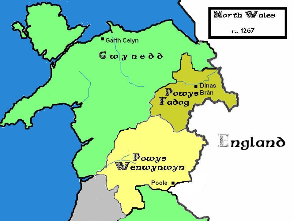
| Description |
English:
Map showing the principalities in north Wales between 1267–76
|
| Source | I created this work entirely by myself. |
| Author | James Frankcom ( talk ) |
| Other versions | updated version with Mawddwy Commote awarded to Powys-Wenwynwyn |


Licensing
|
|
I, the copyright holder of this work, release this work into the
public domain
. This applies worldwide.
In some countries this may not be legally possible; if so: I grant anyone the right to use this work for any purpose , without any conditions, unless such conditions are required by law. |