Oakland_California_aerial_view.jpg
Size of this preview:
800 × 533 pixels
.
Other resolutions:
320 × 213 pixels
|
640 × 427 pixels
|
1,024 × 683 pixels
|
1,500 × 1,000 pixels
.
| Description |
English:
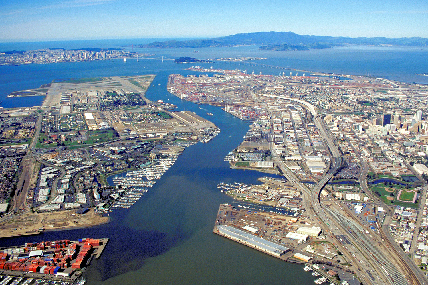
Aerial view of the port of
Oakland, California
, USA. The city of
San Francisco
is clearly visible at top left. The Bay Bridge runs across the the top of the picture, and the
Golden Gate Bridge
can be seen. The runways of the former Alameda Naval Air Station can be seen at left. Downtown Oakland appears at the far right. View is to the west-northwest.
Coordinates:
37°47′43.92″N
122°17′4.57″W
/
37.7955333°N 122.2846028°W
|
||
| Date | not specified or unknown, but some time before 1995, as the Wind River complex between Alaska Basin and the Encinal Yacht Club is shown as a vacant lot | ||
| Source |
U.S. Army Corps of Engineers Digital Visual Library
Image page Image description page Digital Visual Library home page |
||
| Author | Robert Campbell | ||
|
Permission
( Reusing this file ) |
This file is licensed under the
Creative Commons
Attribution-Share Alike 3.0 Unported
license.
|
||
| Location | Oakland, California, USA |

| Annotations | This image is annotated: View the annotations at Commons |