OchlockoneeRiver1975.jpg

Size of this preview:
800 × 514 pixels
.
Other resolutions:
320 × 205 pixels
|
640 × 411 pixels
|
1,024 × 657 pixels
|
1,280 × 822 pixels
|
1,796 × 1,153 pixels
.
Summary
| Description |
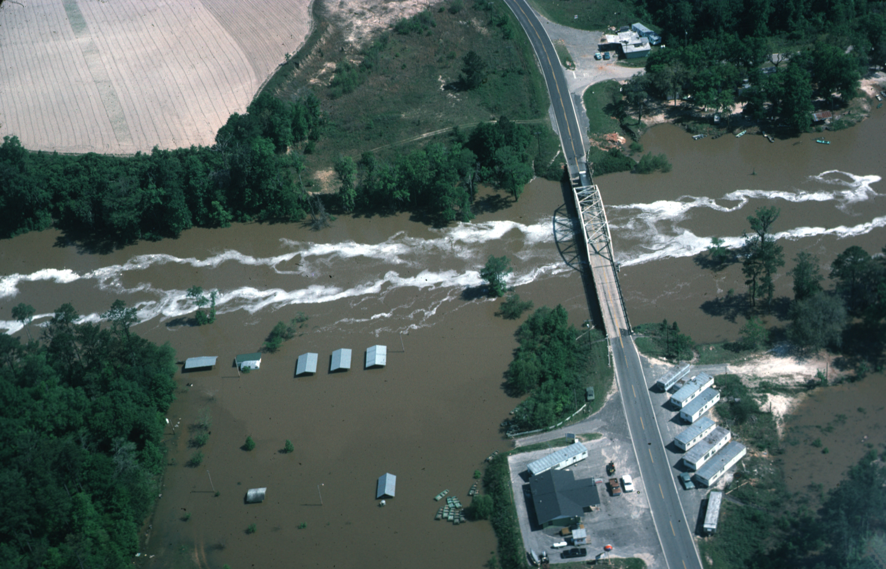
English:
Ochlockonee River
in flood, April 1975. Aerial view of Ochlockonee River near
Bloxham
, Unincorporated
Leon County
, Florida in flood April 16, 1975 at
State Highway 20
and just southwest of the
Talquin Dam
. The bridge shown in the photo was subsequently replaced by one approximately one hundred feet up stream.
|
| Date | |
| Source | USGS Surface Water Photo Gallery [1] , item 14 11 . |
| Author | J.C. Rosenau |
Licensing
|
|
This image is in the
public domain
in the United States because it only contains materials that originally came from the
United States Geological Survey
, an agency of the
United States Department of the Interior
. For more information, see
the official USGS copyright policy
.
|
|
Original upload log
The original description page was
here
. All following user names refer to en.wikipedia.
- 2008-09-03 14:53 Suntag 1796×1153× (1539137 bytes)