Osijek,_Trg_Ante_Starčevića.jpg

Size of this preview:
800 × 533 pixels
.
Other resolutions:
320 × 213 pixels
|
640 × 426 pixels
|
1,024 × 682 pixels
|
1,280 × 853 pixels
|
2,560 × 1,706 pixels
|
4,770 × 3,178 pixels
.
Summary
| Description |
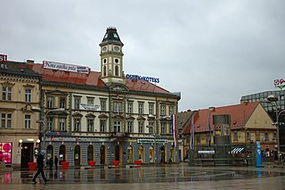
Čeština:
Náměstí Ante Starčeviće v centru Osijeku (Chorvatsko) během předjarního dne. Náměstí bylo po válce kompletně rekonstruované
English:
The square of Ante Starčević in the central part of the town of Osijek, Croatia. The square was completely reconstructed after the war in 1991-1995
|
||||||
| Date | or 2011-03-20 | ||||||
| Source | Own work | ||||||
| Author |
|
||||||

| Camera location |
|
View this and other nearby images on: OpenStreetMap |
|
|---|
Licensing
This file is licensed under the
Creative Commons
Attribution 3.0 Unported
license.
-
You are free:
- to share – to copy, distribute and transmit the work
- to remix – to adapt the work
-
Under the following conditions:
- attribution – You must give appropriate credit, provide a link to the license, and indicate if changes were made. You may do so in any reasonable manner, but not in any way that suggests the licensor endorses you or your use.