Osm-railway-auzd-whole-en-z10-chepetsk.png
Size of this preview:
600 × 600 pixels
.
Other resolutions:
240 × 240 pixels
|
480 × 480 pixels
|
768 × 768 pixels
|
1,024 × 1,024 pixels
|
2,048 × 2,048 pixels
.
| Description |
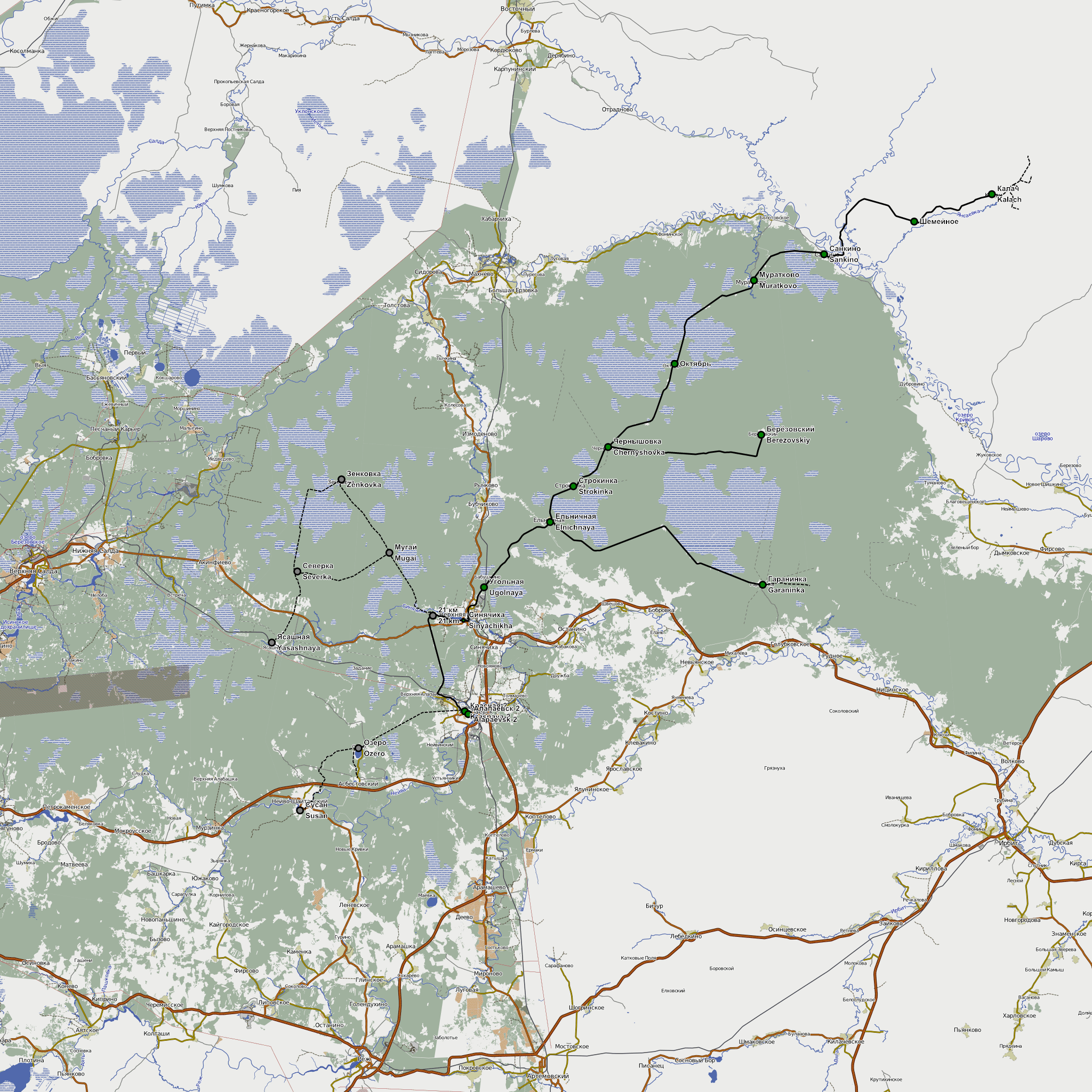
English:
Map of Alapaevsk narrow gauge railway. 02.2012. Background - OpenStreetMap data rendered by
http://Чепецк.net
Русский:
Карта Алапаевской УЖД на 02.2012. Данные: OpenStreetMap
|
| Date | |
| Source | http://openstreetmap.org |
| Author | OpenStreetMap contribtors |
|
Permission
( Reusing this file ) |
This file is licensed under the
Creative Commons
Attribution-Share Alike 2.0 Generic
license.
|