P1010134_Port_Nolloth.JPG

Size of this preview:
800 × 600 pixels
.
Other resolutions:
320 × 240 pixels
|
640 × 480 pixels
|
1,024 × 768 pixels
|
1,280 × 960 pixels
|
2,560 × 1,920 pixels
|
3,264 × 2,448 pixels
.
| Camera location |
|
View this and other nearby images on: OpenStreetMap |
|
|---|
| Description |
English:
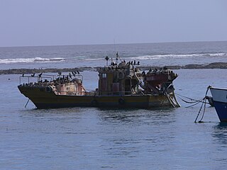
A shipwreek in the Port Nolloth harbour, Northern Cape, South Africa.
Afrikaans:
'n Gesinkte skip in die hawe van Port Nolloth, Suid-Afrika
Deutsch:
gesunkenes Schiff im Hafen von Port Nolloth, Namaqualand, Nordkap, Südafrika
Svenska:
Skeppsvrak, Hamn Port Nolloth, Norra Kapprovinsen, Sydafrika
|
| Date | |
| Source | Own work |
| Author | Winfried Bruenken ( Amrum ) |
|
Permission
( Reusing this file ) |
Own work, share alike, attribution required (Creative Commons CC-BY-SA-2.5) |
I, the copyright holder of this work, hereby publish it under the following license:
This file is licensed under the
Creative Commons
Attribution-Share Alike 2.5 Generic
license.
-
You are free:
- to share – to copy, distribute and transmit the work
- to remix – to adapt the work
-
Under the following conditions:
- attribution – You must give appropriate credit, provide a link to the license, and indicate if changes were made. You may do so in any reasonable manner, but not in any way that suggests the licensor endorses you or your use.
- share alike – If you remix, transform, or build upon the material, you must distribute your contributions under the same or compatible license as the original.