PDA_Mapping.jpg
No higher resolution available.
Summary
| Description |
English:
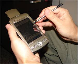
A handheld computer with GPS and GIS software is often used for scientific field work.
|
| Date | |
| Source | Advanced GIS-Based Field Mapping Techniques for Multi-Disciplinary Research: http://geography.wr.usgs.gov/science/mapping.html |
| Author | US Geological Survey: Nathan Wood |
Licensing
|
|
This image is in the
public domain
in the United States because it only contains materials that originally came from the
United States Geological Survey
, an agency of the
United States Department of the Interior
. For more information, see
the official USGS copyright policy
.
|
|