PS1920-1_0-750_sediment-core_hg.jpg

Size of this preview:
620 × 600 pixels
.
Other resolutions:
248 × 240 pixels
|
496 × 480 pixels
|
794 × 768 pixels
|
1,059 × 1,024 pixels
|
1,558 × 1,507 pixels
.
| Description |
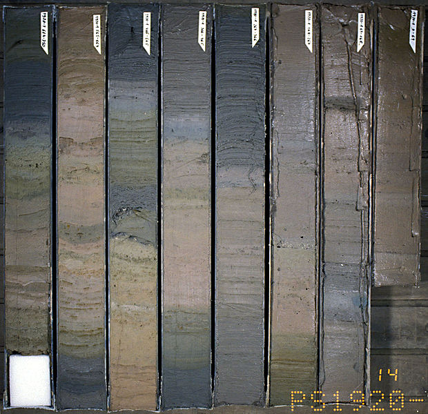
English:
Sediment core
, taken with a gravity corer at the Greenland continental slope,
74°59′46″N
11°03′36″W
/
74.996°N 11.06°W
.
Русский:
Колонка длиной 7,63 метров (номер PS1920-1), полученная 01.09.1990 в результате бурения дна на глубине 2726 м под водой НИС «Поларштерн» на материковом склоне Гренландии (точка с координатами
74°59′46″N
11°03′36″W
/
74.996°N 11.06°W
) во время экспедиции ARK-VIII/3. Хранится в Институте полярных и морских исследований им. Альфреда Вегенера.
|
| Date | |
| Source | Own work |
| Author | Hannes Grobe ( talk ) |
This file is licensed under the
Creative Commons
Attribution 3.0 Unported
license.
-
You are free:
- to share – to copy, distribute and transmit the work
- to remix – to adapt the work
-
Under the following conditions:
- attribution – You must give appropriate credit, provide a link to the license, and indicate if changes were made. You may do so in any reasonable manner, but not in any way that suggests the licensor endorses you or your use.