Pacaya_erupting_in_1976.jpg
Size of this preview:
800 × 522 pixels
.
Other resolutions:
320 × 209 pixels
|
640 × 417 pixels
|
969 × 632 pixels
.
Summary
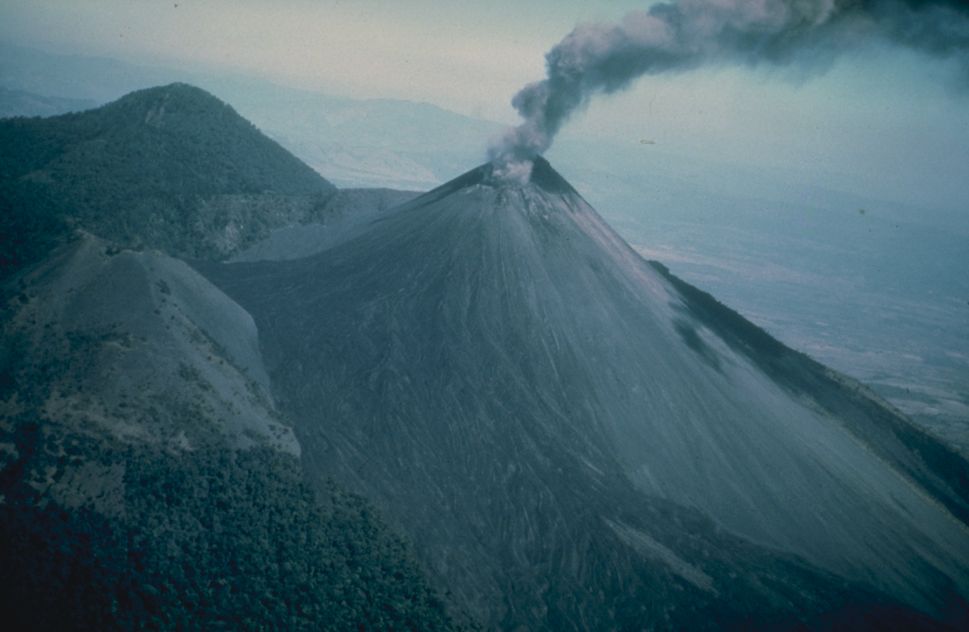
| Description | Ashy eruption at Pacaya, shortly after a very large earthquake affected the area in 1976. Photo credit: USGS. . |
| Date | |
| Source | From [1] |
| Author | USGS |
Licensing
|
|
This image is in the
public domain
in the United States because it only contains materials that originally came from the
United States Geological Survey
, an agency of the
United States Department of the Interior
. For more information, see
the official USGS copyright policy
.
|
|
Original upload log
The original description page was
here
. All following user names refer to en.wikipedia.
- 2005-04-06 14:27 Worldtraveller 969×632×8 (61084 bytes) Ashy eruption at Pacaya, shortly after a very large earthquake affected the area in 1976. Photo credit: USGS. From [http://www.ngdc.noaa.gov/seg/hazard/slideset/28/28_576_slide.shtml]. {{PD-USGov-Interior-USGS}}