Paestum_BW_2013-05-17_13-58-28.jpg

Size of this preview:
800 × 548 pixels
.
Other resolutions:
320 × 219 pixels
|
640 × 438 pixels
|
1,024 × 701 pixels
|
1,280 × 877 pixels
|
2,560 × 1,753 pixels
|
3,560 × 2,438 pixels
.
Summary
| Description |
Deutsch:
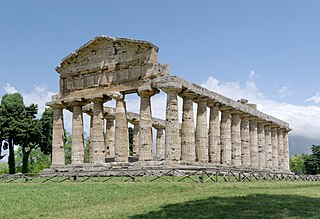
Italien, Paestum, Athena Tempel
English:
Italy, Paestum, Temple of Athena
Italiano:
Paestum, Tempio di Athena o di Cerere
|
| Date | |
| Source | Own work |
| Author | Berthold Werner |
| Camera location |
|
View this and other nearby images on: OpenStreetMap |
|
|---|
Licensing
This file is licensed under the
Creative Commons
Attribution-Share Alike 3.0 Unported
license.
Attribution:
Berthold Werner
-
You are free:
- to share – to copy, distribute and transmit the work
- to remix – to adapt the work
-
Under the following conditions:
- attribution – You must give appropriate credit, provide a link to the license, and indicate if changes were made. You may do so in any reasonable manner, but not in any way that suggests the licensor endorses you or your use.
- share alike – If you remix, transform, or build upon the material, you must distribute your contributions under the same or compatible license as the original.

|
This image has been assessed under the valued image criteria and is considered the most valued image on Commons within the scope: Temple of Athena (Paestum), view from SW . You can see its nomination here . |
|
|
This image has been assessed using the
Quality image guidelines
and is considered a
Quality image
.
|