Pakistan_Mud_Volcanoes.jpg

Size of this preview:
600 × 600 pixels
.
Other resolutions:
240 × 240 pixels
|
480 × 480 pixels
|
768 × 768 pixels
|
1,024 × 1,024 pixels
|
2,048 × 2,048 pixels
|
3,207 × 3,207 pixels
.
Summary
| Description |
English:
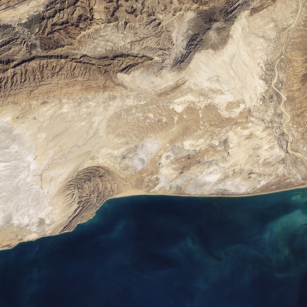
This natural-colour image shows the most dramatic group of mud volcanoes in the area, known as the Changradup Complex, Pakistan. The tallest
mud volcano
, Changradup I, is about 100 meters high, and it has a 15-meter diameter
mud
lake
in its crater that periodically overflows. Some of these overflows have darkened the north-western flanks. A second crater emerges from the southern flanks of Changradup, but it is not currently active. The 45-meter Chandragup II lies north-east of the taller cone, and its crater is filled by a mud lake with a figure-8 shape, probably the result of twin volcanoes whose craters collapsed into each other over time. To the north-west of Changradup I, the eroded rim of an extinct mud volcano is visible; its eastern rim is more noticeable than its western rim.
|
| Date | |
| Source | NASA Earth Observatory |
| Author | Robert Simmon |
This image was captured by the Advanced Land Imager on NASA’s Earth Observing-1 (EO-1) satellite.
Licensing
|
|
This file is in the public domain in the United States because it was solely created by NASA . NASA copyright policy states that "NASA material is not protected by copyright unless noted ". (See Template:PD-USGov , NASA copyright policy page or JPL Image Use Policy .) |
|

|
Warnings:
|
| Annotations | This image is annotated: View the annotations at Commons |