PalmerLandstubmap.png
No higher resolution available.
Summary
| Description |
English:
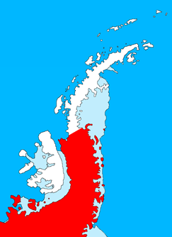
Outline map of the Antarctic Peninsula showing
Palmer Land
.
Drawn by me (User:Grutness) based on
File:Ant-pen_map.png
by Giovanni Fattori.
|
| Date | 2 July 2011 (original upload date) |
| Source | Transferred from en.wikipedia to Commons. |
| Author | The original uploader was Grutness at English Wikipedia . |
Licensing

|
Permission is granted to copy, distribute and/or modify this document under the terms of the GNU Free Documentation License , Version 1.2 or any later version published by the Free Software Foundation ; with no Invariant Sections, no Front-Cover Texts, and no Back-Cover Texts. A copy of the license is included in the section entitled GNU Free Documentation License . |
Original upload log
The original description page was
here
. All following user names refer to en.wikipedia.
- 2011-07-02 09:39 Grutness 243×334× (33143 bytes) Outline map of the Antarctic Peninsula showing [[Palmer Land]]. Drawn by me (User:Grutness) based on [[:File:Ant-pen_map.png]] by Giovanni Fattori.{{GFDL}}