Panama_Canal_-_Pacific_Side_Entrance.jpg
Size of this preview:
726 × 599 pixels
.
Other resolutions:
291 × 240 pixels
|
582 × 480 pixels
|
831 × 686 pixels
.
Summary
| Description |
English:
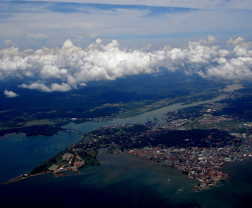
Pacific Side Entrance of the Panama Canal. In the foreground part of Panama city is visible together with the Bridge of the Americas. In the background (right) Miraflores Locks are also visible.
|
| Date | Taken on 16 March 2012 |
| Source |
https://www.flickr.com/photos/milhoooox/1454717385/sizes/l/in/set-72157603216901000/
|
| Author |
|
| Camera location |
|
View this and other nearby images on: OpenStreetMap |
|
|---|
Licensing
|
|
This image, originally posted to Flickr , was reviewed on 16 March 2012 by the administrator or reviewer Materialscientist , who confirmed that it was available on Flickr under the stated license on that date. |
This file is licensed under the
Creative Commons
Attribution-Share Alike 2.0 Generic
license.
-
You are free:
- to share – to copy, distribute and transmit the work
- to remix – to adapt the work
-
Under the following conditions:
- attribution – You must give appropriate credit, provide a link to the license, and indicate if changes were made. You may do so in any reasonable manner, but not in any way that suggests the licensor endorses you or your use.
- share alike – If you remix, transform, or build upon the material, you must distribute your contributions under the same or compatible license as the original.
| Annotations | This image is annotated: View the annotations at Commons |


|
This image has been assessed under the valued image criteria and is considered the most valued image on Commons within the scope: Panama Canal (Pacific side entrance) . You can see its nomination here . |