Pannonia01.png
Size of this preview:
668 × 599 pixels
.
Other resolutions:
268 × 240 pixels
|
535 × 480 pixels
|
1,001 × 898 pixels
.
Summary
| Description |
English:
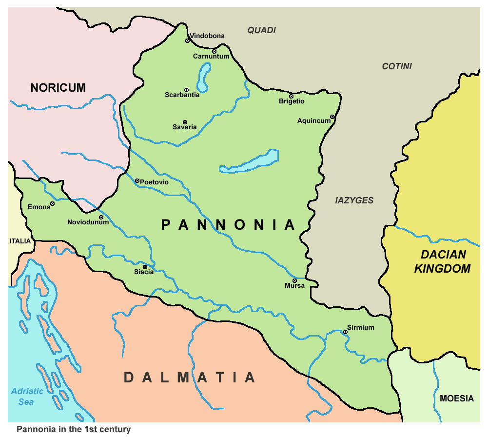
Historic map - Roman Pannonia in the 1st century.
Српски / srpski:
Istorijska karta - Rimska Panonija u 1. veku.
|
| Date | |
| Source |
|
| Author | en:User:PANONIAN |
| Other versions | Magyar svg |
Licensing
|
|
This work has been released into the
public domain
by its author,
PANONIAN
at
English Wikipedia
. This applies worldwide.
In some countries this may not be legally possible; if so: PANONIAN grants anyone the right to use this work for any purpose , without any conditions, unless such conditions are required by law. |
References
- Dragan Brujić, Vodič kroz Svet antike, Beograd, 2005.
- Školski istorijski atlas, Zavod za izdavanje udžbenika SR Srbije, Beograd, 1970.
- http://www.hipkiss.org/data/maps/j-m-dent-and-sons_atlas-of-ancient-and-classical-geography_1912_vindelicia-rhaetia-noricum-pannonia-illyricim-austria-hungry-balkans_2599_2067_600.jpg
- http://www.emersonkent.com/images/maps/thrace_map.jpg
- http://www.miklianmaps.com/images/1879%20ginn%20heath%2009%20pannonia.jpg
- File:Roman provinces of Illyricum, Macedonia, Moesia, Pannonia and Thracia.jpg
- File:Roman provinces in a 1867 school atlas.jpg