Panorama-os-hbf.jpg

Size of this preview:
800 × 385 pixels
.
Other resolutions:
320 × 154 pixels
|
640 × 308 pixels
|
1,024 × 492 pixels
|
1,280 × 615 pixels
|
2,560 × 1,231 pixels
|
5,200 × 2,500 pixels
.
| Description |
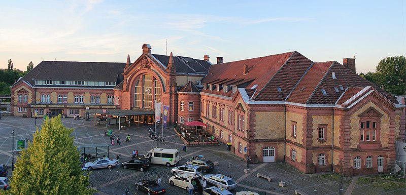
Deutsch:
Panoramabild des
Osnabrücker Hauptbahnhofs
. Diese Panoramaaufnahme wurde aus fünf Einzelaufnahmen mit
PTGui
erstellt.
English:
A panoramic of the central station of
Osnabrück
, Germany. This image is stitched from five single shots using
PTGui
.
|
||
| Date | |||
| Source | Own work | ||
| Author | A.Savin | ||
|
Permission
( Reusing this file ) |
.svg)
Just attribute the author: « A.Savin, Wikipedia »; if you have questions —
Telegram
, or e-mail to
[email protected]
.
.svg)
Просто укажите в качестве автора: « А.Савин, Википедия »; если есть вопрос —
телеграм
, или эл.почта на
[email protected]
.

Kennzeichnen Sie einfach als Autor: « A.Savin, Wikipedia »; falls Sie Fragen haben —
Telegram
, oder E-Mail an
[email protected]
.
Thank you. |

| Camera location |
|
View this and other nearby images on: OpenStreetMap |
|
|---|
|
|
This image has been assessed using the
Quality image guidelines
and is considered a
Quality image
.
|
Licensing
|
|
Copyleft: This work of art is free; you can redistribute it and/or modify it according to terms of the Free Art License . You will find a specimen of this license on the Copyleft Attitude site as well as on other sites . |
This file is licensed under the
Creative Commons
Attribution-Share Alike
3.0 Unported
,
2.5 Generic
,
2.0 Generic
and
1.0 Generic
license.
-
You are free:
- to share – to copy, distribute and transmit the work
- to remix – to adapt the work
-
Under the following conditions:
- attribution – You must give appropriate credit, provide a link to the license, and indicate if changes were made. You may do so in any reasonable manner, but not in any way that suggests the licensor endorses you or your use.
- share alike – If you remix, transform, or build upon the material, you must distribute your contributions under the same or compatible license as the original.