Parliament_House,_Canberra,_Pano_jjron_25.9.2008-edit1.jpg
Size of this preview:
799 × 182 pixels
.
Other resolutions:
320 × 73 pixels
|
640 × 146 pixels
|
1,024 × 233 pixels
|
1,280 × 292 pixels
|
6,101 × 1,391 pixels
.
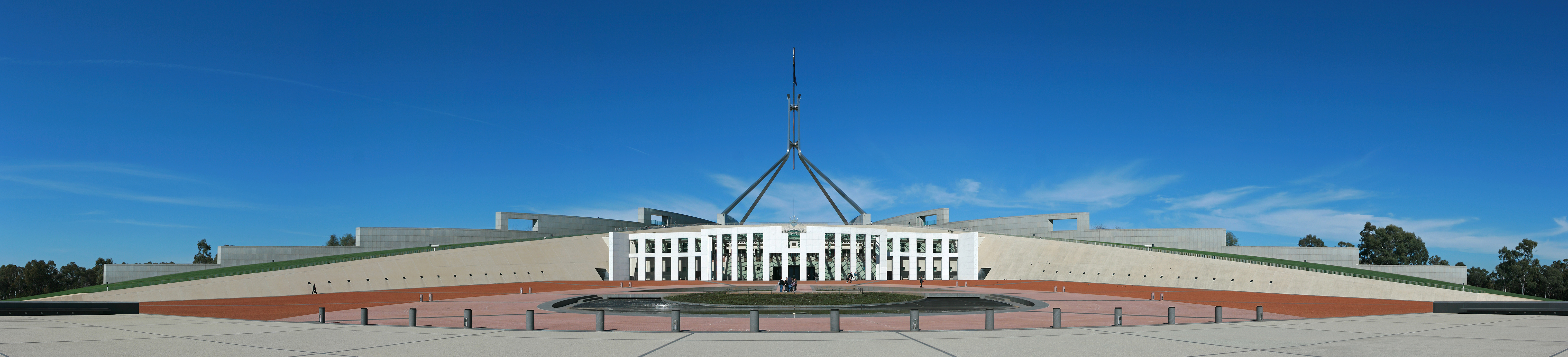
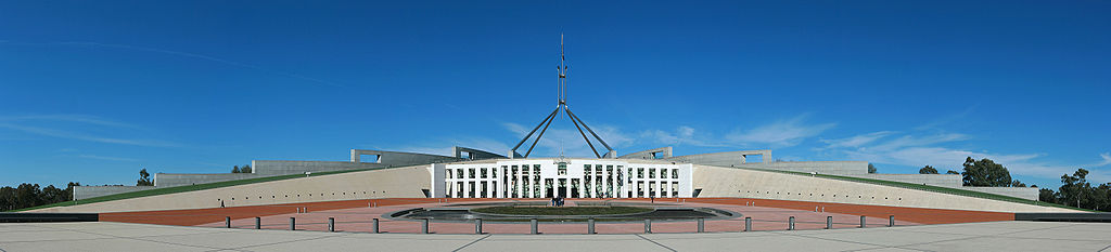
| Description | Panoramic view of the front architecture of Australia's 'new' Parliament House built into Capital Hill and showing the 'boomerang' shaped design. Construction was completed at a cost of over AU$1.1 billion and the building opened in 1988 as part of Australia's bicentennial celebrations. Canberra, ACT, Australia. | |||
| Date | ||||
| Source | Own work | |||
| Author | jjron | |||
|
Permission
( Reusing this file ) |
|
|||
| Other versions |
|
|
| Camera location |
|
View this and other nearby images on: OpenStreetMap |
|
|---|
Licensing
I, the copyright holder of this work, hereby publish it under the following license:

|
Permission is granted to copy, distribute and/or modify this document under the terms of the GNU Free Documentation License , Version 1.2 only as published by the Free Software Foundation ; with no Invariant Sections, no Front-Cover Texts, and no Back-Cover Texts. A copy of the license is included in the section entitled GNU Free Documentation License . | 1.2 only |