Pedro_Teixeira_Albernaz_(1656)_Madrid.png

Size of this preview:
800 × 508 pixels
.
Other resolutions:
320 × 203 pixels
|
640 × 406 pixels
|
1,024 × 650 pixels
|
1,280 × 813 pixels
|
2,560 × 1,625 pixels
|
3,823 × 2,427 pixels
.
Summary
| Description |
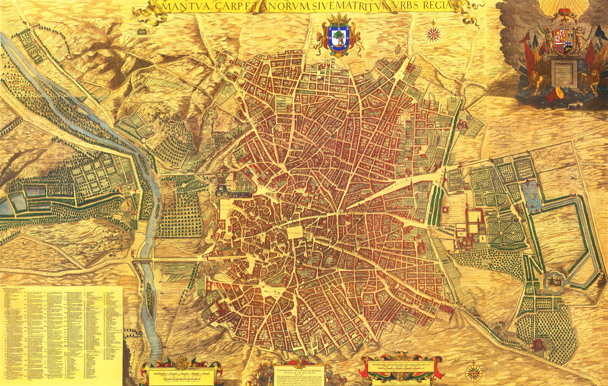
Español:
Plano de la villa de Madrid
dibujado por
Pedro Teixeira Albernaz
en
1656
, por encargo de
Felipe IV de España
. Se identifican sus calles, plazas y edificios, muchos señalados con sus nombres. El plano está realizado en perspectiva caballera, de sur a norte. Está grabado en 20 planchas de 45x56 cm cada una, midiendo 2,85 x 1,80 metros, a una escala de 1:1.800.
|
|||||||||||||||||||
| Date | ||||||||||||||||||||
| Source | Mantua Carpetanorum sive Matritum Urbs Regia (Madrid Ciudad Regia) conocido como «el plano de Teixeira». | |||||||||||||||||||
| Author |
|
|||||||||||||||||||
|
Permission
( Reusing this file ) |
PD-art/1656 | |||||||||||||||||||
| Other versions |

|
|||||||||||||||||||
| Camera location |
|
View this and other nearby images on: OpenStreetMap |
|
|---|
_plano_de_Madrid.png¶ms=040.415428_N_-003.707502_E_globe:Earth_type:camera__&language=en)
Licensing
|
This is a faithful photographic reproduction of a two-dimensional,
public domain
work of art. The work of art itself is in the public domain for the following reason:
The official position taken by the Wikimedia Foundation is that "
faithful reproductions of two-dimensional public domain works of art are public domain
".
This photographic reproduction is therefore also considered to be in the public domain in the United States. In other jurisdictions, re-use of this content may be restricted; see Reuse of PD-Art photographs for details. |
||||