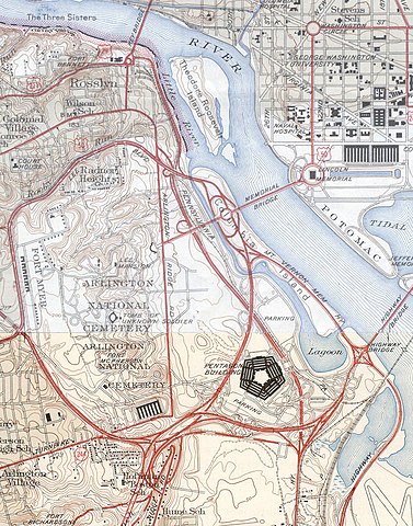
Pentagon_road_network_map_1945.jpg

Size of this preview:
470 × 599 pixels
.
Other resolutions:
188 × 240 pixels
|
377 × 480 pixels
|
1,020 × 1,300 pixels
.
|
|
This image is in the
public domain
in the United States because it only contains materials that originally came from the
United States Geological Survey
, an agency of the
United States Department of the Interior
. For more information, see
the official USGS copyright policy
.
|
|
| Description |
USGS topos covering the area around the Pentagon in Virginia, soon after the road network was built. Note that the Shirley Highway near the south edge of the map was added later, as it opened in 1943.
|
|||||||||
| Source |
|
|||||||||
| Geotemporal data | ||||||||||
| Bounding box |
|
|||||||||
| Georeferencing | ||||||||||