PeriplusAncientMap.jpg
Size of this preview:
763 × 600 pixels
.
Other resolutions:
305 × 240 pixels
|
611 × 480 pixels
|
977 × 768 pixels
|
1,280 × 1,006 pixels
|
1,524 × 1,198 pixels
.
Summary
| Description |
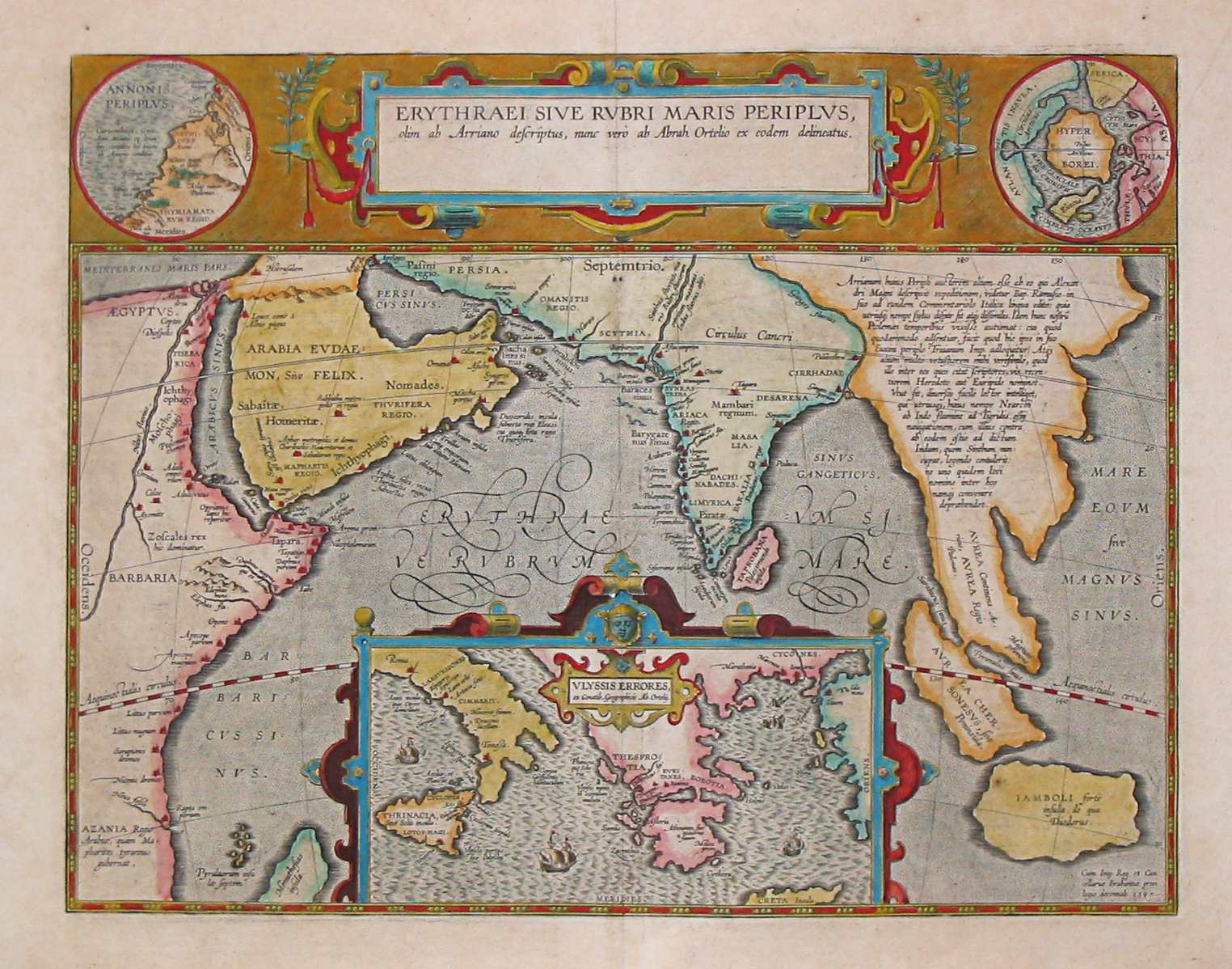
English:
Map by Abraham Ortelius, (1527-1598) for the
Periplus Maris Erythraei
(Περίπλους τὴς Ἐρυθράς Θαλάσσης "Periplus of the Erythraean Sea"), attributed to Arrian.
|
|||||||||||||||||||||||
| Date | ||||||||||||||||||||||||
| Source | Plate [162] from: Theatrum orbus terrarum / Abraham Ortelius. Antverpiae: Apud Ioannem Bapt. Vrintium, 1609. | |||||||||||||||||||||||
| Author |
|
|||||||||||||||||||||||

See also:
Licensing
|
This is a faithful photographic reproduction of a two-dimensional,
public domain
work of art. The work of art itself is in the public domain for the following reason:
The official position taken by the Wikimedia Foundation is that "
faithful reproductions of two-dimensional public domain works of art are public domain
".
This photographic reproduction is therefore also considered to be in the public domain in the United States. In other jurisdictions, re-use of this content may be restricted; see Reuse of PD-Art photographs for details. |
||||