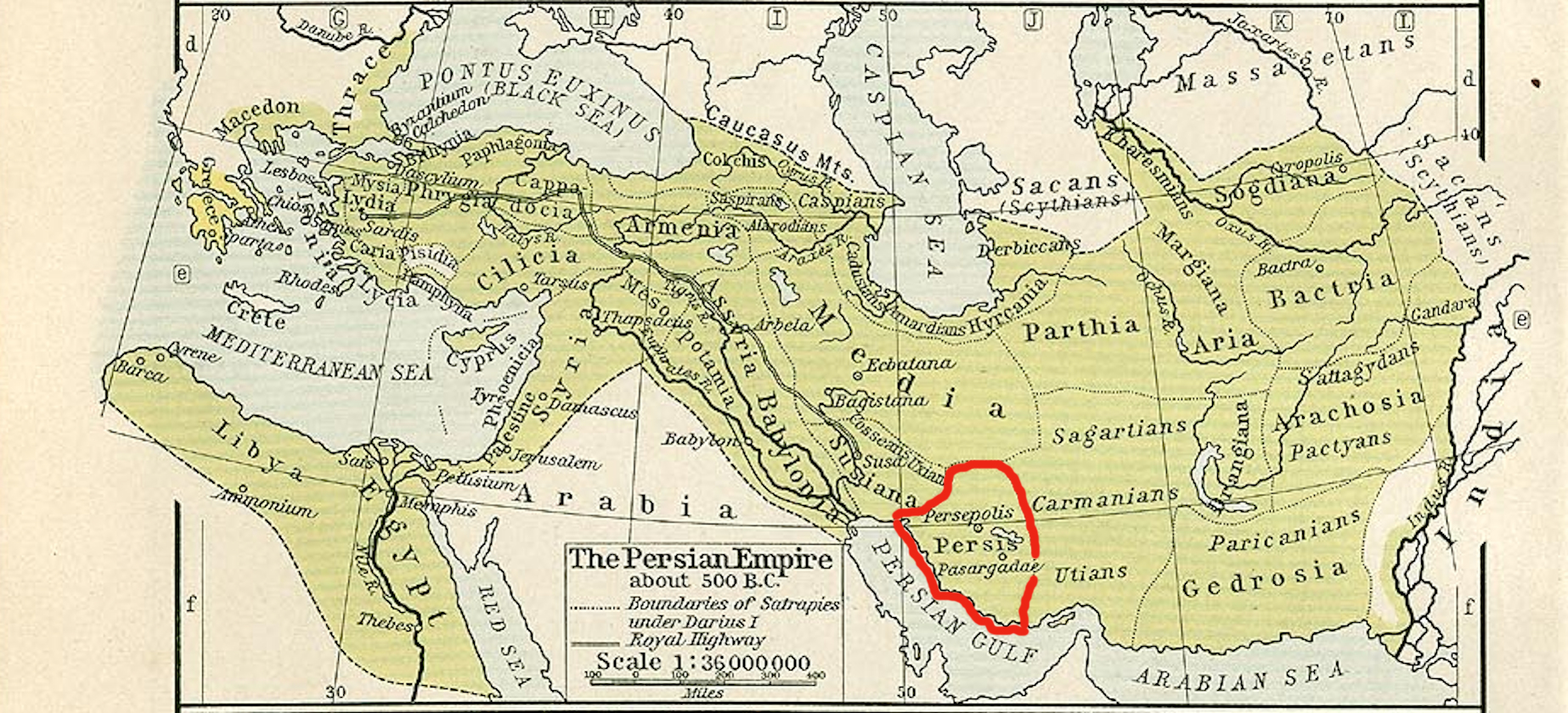
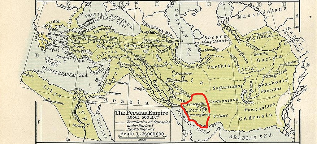
Persis_map.jpg
Size of this preview:
800 × 364 pixels
.
Other resolutions:
320 × 146 pixels
|
640 × 291 pixels
|
1,024 × 466 pixels
|
1,846 × 840 pixels
.
Summary
| Description |
English:
Persis map
|
||||||||||||||||||||||
| Date | |||||||||||||||||||||||
| Source |
This file was derived from:
The Persian Empire, about 500 BC - Historical Athlas - William R. Shepherd - Henry Holt and Company, 1911.png
|
||||||||||||||||||||||
| Author |
|
||||||||||||||||||||||
Licensing
|
|
The author died in 1934, so this work is in the public domain in its country of origin and other countries and areas where the copyright term is the author's life plus 80 years or fewer . This work is in the public domain in the United States because it was published (or registered with the U.S. Copyright Office ) before January 1, 1929. |
| This file has been identified as being free of known restrictions under copyright law, including all related and neighboring rights. | |