Photograph_Gap_Utah.jpeg

Size of this preview:
800 × 600 pixels
.
Other resolutions:
320 × 240 pixels
|
640 × 480 pixels
|
1,024 × 768 pixels
|
1,280 × 960 pixels
|
2,560 × 1,920 pixels
.
Summary
| Description |
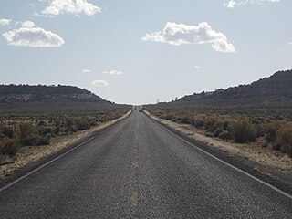
English:
Utah State Route 211
runs westward through Dry Valley to Photograph Gap, site of the
utopian
community called
Home of Truth
, now a
ghost town
.
|
| Date | |
| Source | Own work |
| Author | Ntsimp |
| Camera location |
|
View this and other nearby images on: OpenStreetMap |
|
|---|
Licensing
|
|
I, the copyright holder of this work, release this work into the
public domain
. This applies worldwide.
In some countries this may not be legally possible; if so: I grant anyone the right to use this work for any purpose , without any conditions, unless such conditions are required by law. |