Pilkington_Canal,_Thamesmead_-_geograph.org.uk_-_369840.jpg
No higher resolution available.
Summary
| Description |
English:
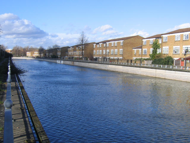
Pilkington Canal, Thamesmead Only the first few hundred metres remain at the Thames end of the Pilkington Canal, and its connection to the river has been severed by recent development. It remains as a water feature in the Thamesmead housing development.
|
| Date | |
| Source | From geograph.org.uk |
| Author | Stephen Craven |
|
Attribution
( required by the license ) |
Stephen Craven / Pilkington Canal, Thamesmead / |
| Camera location |
|
View this and other nearby images on: OpenStreetMap |
|
|---|
_heading:0.00&language=en)
| Object location |
|
View this and other nearby images on: OpenStreetMap |
|
|---|
_heading:0.00&language=en)
Licensing

|
This image was taken from the
Geograph project
collection. See
this photograph's page
on the Geograph website for the photographer's contact details. The copyright on this image is owned by
Stephen Craven
and is licensed for reuse under the
Creative Commons
Attribution-ShareAlike 2.0 license.
|
This file is licensed under the
Creative Commons
Attribution-Share Alike 2.0 Generic
license.
Attribution:
Stephen Craven
-
You are free:
- to share – to copy, distribute and transmit the work
- to remix – to adapt the work
-
Under the following conditions:
- attribution – You must give appropriate credit, provide a link to the license, and indicate if changes were made. You may do so in any reasonable manner, but not in any way that suggests the licensor endorses you or your use.
- share alike – If you remix, transform, or build upon the material, you must distribute your contributions under the same or compatible license as the original.