Political_Map_of_South_Africa_drawn_1897_reprint_1899.jpg
No higher resolution available.
Summary
| Description |
English:
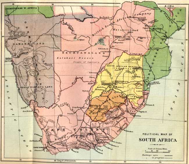
Political Map of South Africa drawn 1897 reprint 1899. Included in "Impressions of South Africa" by James Bryce Third Edition 1899 reprinted. Project Gutenberg file.
|
| Date | |
| Source |
https://www.gutenberg.org/cache/epub/22323/pg22323-images.html Project Gutenberg Book IMPRESSIONS OF SOUTH AFRICA BY JAMES BRYCE 1899 (reprint) where the author records permission to use the map prepared by Sir Donald Currie and Messrs. A.S. and G.G. Brown and previously printed in "Guide to South Africa" (published by the Castle Mail Packets Company) |
| Author | Sir Donald Currie and Messrs. A.S. and G.G. Brown |
Political map of South Africa 1897
Licensing
|
|
This work is in the public domain in its country of origin and other countries and areas where the copyright term is the author's life plus 70 years or fewer . This work is in the public domain in the United States because it was published (or registered with the U.S. Copyright Office ) before January 1, 1929. |
| This file has been identified as being free of known restrictions under copyright law, including all related and neighboring rights. | |