Ptolemy
:
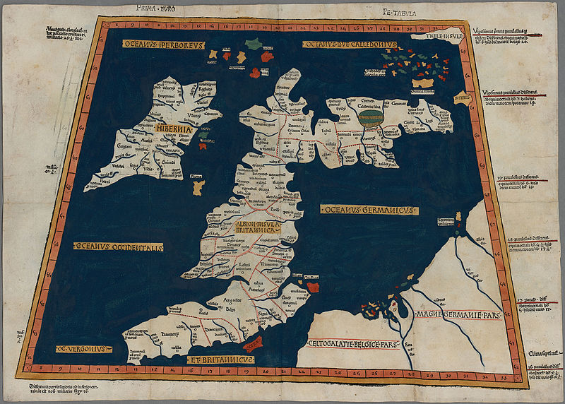
Prima Europe Tabula


|
|
Artist
|
|
|
|
Title
|
Prima Europe tabula
|
|
Part of
|
Geography

|
|
Object type
|
map
|
|
Description
|
One of the earliest surviving copies of Ptolemy's 2nd century map of the British Isles. Originally published in Ptolemy's Geographia. This is the second issue of the 1482 map, also printed at Ulm, which was the first woodcut map of the British Isles and the first to be printed outside Italy.
|
|
Date
|
1486
date QS:P571,+1486-00-00T00:00:00Z/9
|
|
Dimensions
|
height: 350 mm (13.77 in); width: 500 mm (19.68 in)
dimensions QS:P2048,350U174789
dimensions QS:P2049,500U174789
|
|
Collection
|
institution QS:P195,Q666063
|
|
Notes
|
Scale not given
|
|
Source/Photographer
|
-
The National Library of Wales
|
Permission
(
Reusing this file
)
|
|
Public domain
Public domain
false
false
|

|
This work is in the
public domain
in its country of origin and other countries and areas where the
copyright term
is the author's
life plus 100 years or fewer
.
This work is in the
public domain
in the
United States
because it was
published
(or registered with the
U.S. Copyright Office
) before January 1, 1929.
|
|
This file has been identified as being free of known restrictions under copyright law, including all related and neighboring rights.
|
https://creativecommons.org/publicdomain/mark/1.0/
PDM
Creative Commons Public Domain Mark 1.0
false
false
|


