Project_SPIRE_Inertial_Navigation_Control.jpg

Size of this preview:
800 × 450 pixels
.
Other resolutions:
320 × 180 pixels
|
640 × 360 pixels
|
1,024 × 576 pixels
|
1,280 × 720 pixels
|
2,560 × 1,440 pixels
|
5,426 × 3,053 pixels
.
Summary
| Description |
English:
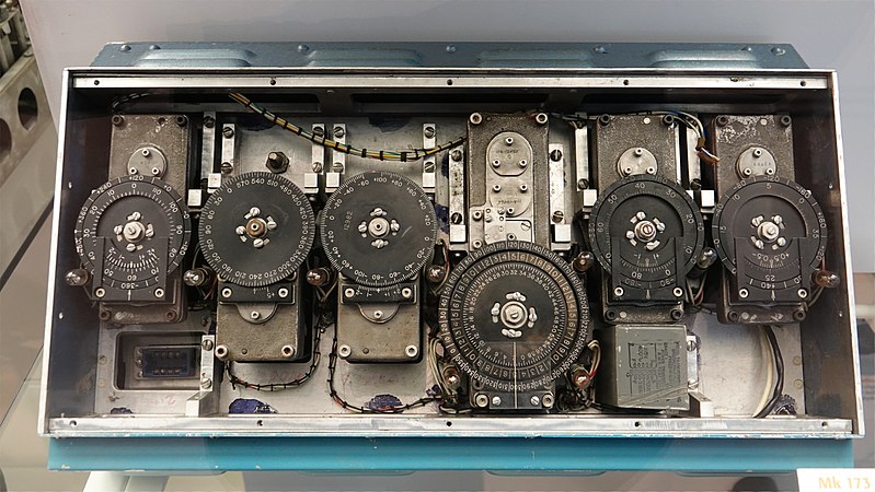
During the early 1950s, Charles Draper’s team at MIT developed a prototype pure inertial reference system to guide submarines, missiles, and aircraft, known as Space Inertial Reference Earth (SPIRE). It used gyroscopes and accelerometers connected to a computer to determine position without emitting signals that could reveal position or relying on external signals that might be vulnerable to enemy interference.
On February 8, 1953, SPIRE guided a B-29 from New Bedford, Massachusetts to Los Angeles entirely under automatic control. As the first truly successful demonstration of inertial navigation, it ushered in the rapid adoption of inertial navigation systems by the US. Navy and Air Force. Picture taken at the National Air and Space Museum's Steven F. Udvar-Hazy Center in Chantilly, Virginia, USA. Gift of the Massachusetts Institute of Technology. |
| Date | |
| Source | Own work |
| Author | Sanjay Acharya |
| Camera location |
|
View this and other nearby images on: OpenStreetMap |
|
|---|
Licensing
I, the copyright holder of this work, hereby publish it under the following license:
This file is licensed under the
Creative Commons
Attribution-Share Alike 4.0 International
license.
-
You are free:
- to share – to copy, distribute and transmit the work
- to remix – to adapt the work
-
Under the following conditions:
- attribution – You must give appropriate credit, provide a link to the license, and indicate if changes were made. You may do so in any reasonable manner, but not in any way that suggests the licensor endorses you or your use.
- share alike – If you remix, transform, or build upon the material, you must distribute your contributions under the same or compatible license as the original.