Proposed_map_of_Long_Island_and_New_York_City_as_independent_state.svg

Size of this PNG preview of this SVG file:
787 × 600 pixels
.
Other resolutions:
315 × 240 pixels
|
630 × 480 pixels
|
1,008 × 768 pixels
|
1,280 × 976 pixels
|
2,560 × 1,951 pixels
|
6,599 × 5,030 pixels
.
Summary
| Description |
English:
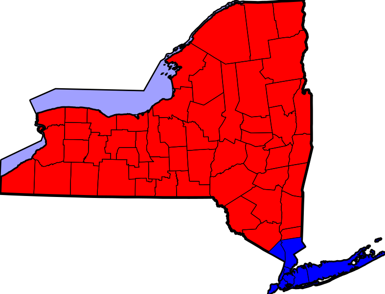
Proposed map of Long Island and New York City as independent state. The blue area includes New York City, the Long Island counties of Nassau and Suffolk, and Rockland and Westchester Counties north of the city. Based on PNG:
http://en.wikipedia.org/wiki/File:NYSseccession.png
Using existing New York county map SVG:
https://commons.wikimedia.org/wiki/File:Map_of_New_York_highlighting_Albany_County.svg
|
| Date | |
| Source | Own work |
| Author | Crazytonyi |
Licensing
I, the copyright holder of this work, hereby publish it under the following license:
This file is licensed under the
Creative Commons
Attribution-Share Alike 4.0 International
license.
-
You are free:
- to share – to copy, distribute and transmit the work
- to remix – to adapt the work
-
Under the following conditions:
- attribution – You must give appropriate credit, provide a link to the license, and indicate if changes were made. You may do so in any reasonable manner, but not in any way that suggests the licensor endorses you or your use.
- share alike – If you remix, transform, or build upon the material, you must distribute your contributions under the same or compatible license as the original.