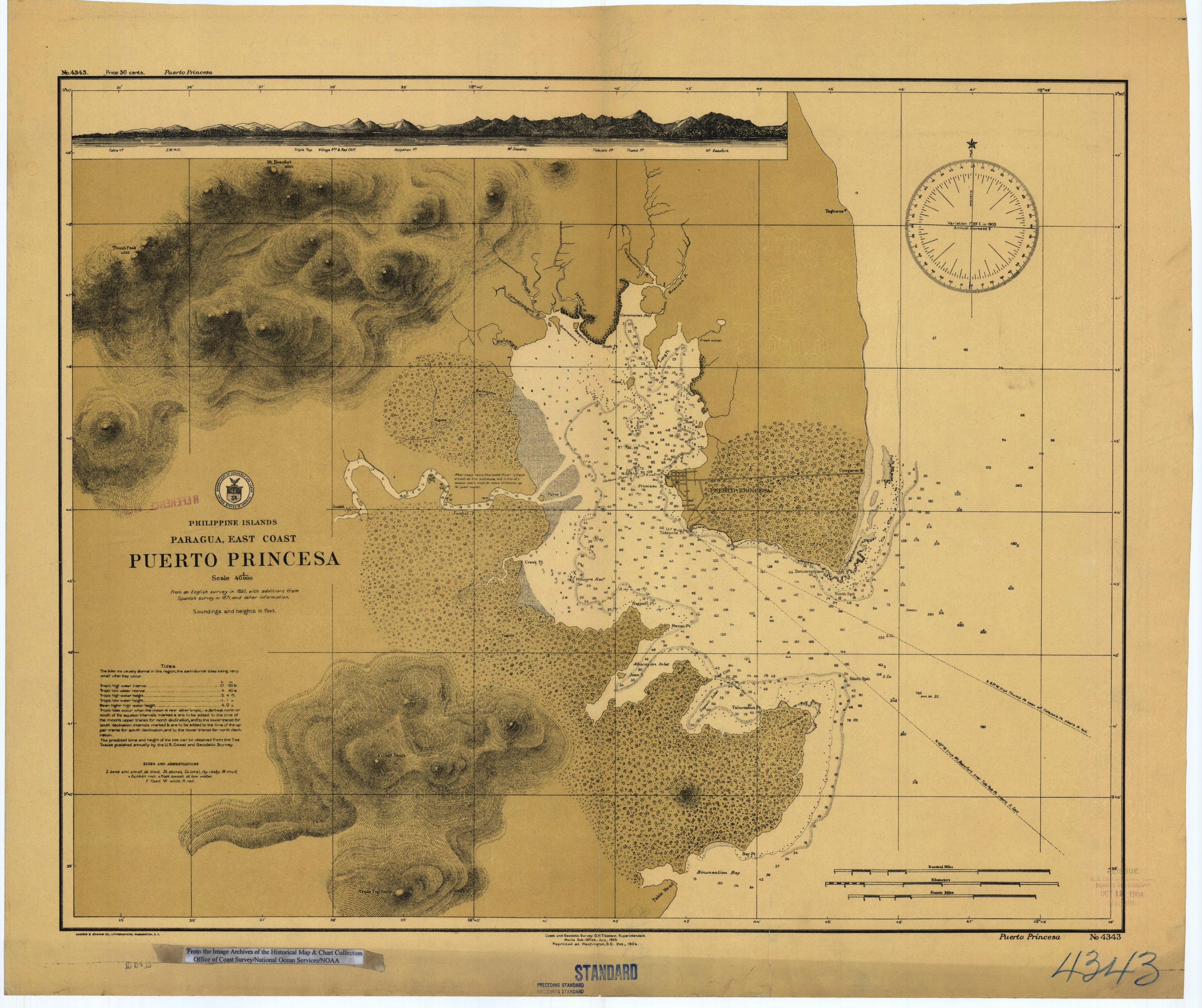
Puertoprincesa_chart4343_1904.jpeg
Size of this preview:
715 × 600 pixels
.
Other resolutions:
286 × 240 pixels
|
572 × 480 pixels
|
916 × 768 pixels
|
1,221 × 1,024 pixels
|
2,442 × 2,048 pixels
|
3,053 × 2,561 pixels
.
| Description |
English:
Scanned image of US Coast & Geodetic Survey (Manila Office) nautical chart #4343 Puerto Princesa, (Paragua), Palawan, Philippines.
|
|||
| Date | ||||
| Source |
English:
From the image archives of the
Historical Map & Chart Collection
/Office of Coast Survey/National Ocean Service/NOAA/United States government. Converted from MrSID to JPEG format for upload to Commons.
|
|||
| Author | Coast and Geodetic Survey O.H. Tittmann, Superintendent. Manila Sub-Office. July 1903 | |||
|
Permission
( Reusing this file ) |
|