RedArmy19Aug31Dec44.jpg
Size of this preview:
788 × 600 pixels
.
Other resolutions:
315 × 240 pixels
|
631 × 480 pixels
|
1,009 × 768 pixels
|
1,256 × 956 pixels
.
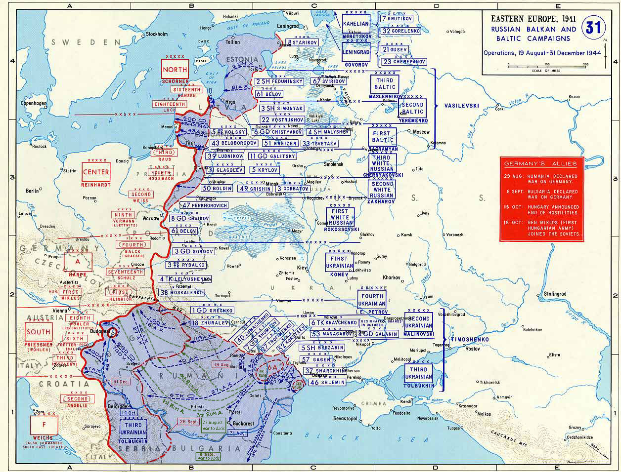
Taken from the campaign series, made public by the US-Army under www.dean.usma.edu The picture is public domain. It shows the situation of the Easter Front from 13. Aug. '44 until 31. Dec. '44
- Source: dean.usma.edu archive copy at the Wayback Machine
From website:
- In 1938 the predecessors of what is today The Department of History at the United States Military Academy began developing a series of campaign atlases to aid in teaching cadets a course entitled, "History of the Military Art." Since then, the Department has produced over six atlases and more than one thousand maps, encompassing not only America’s wars but global conflicts as well.
- In keeping abreast with today's technology, the Department of History is providing these maps on the internet as part of the department's outreach program. The maps were created by the United States Military Academy’s Department of History and are the digital versions from the atlases printed by the United States Defense Printing Agency. We gratefully acknowledge the accomplishments of the department's former cartographer, Mr. Edward J. Krasnoborski, along with the works of our present cartographer, Mr. Frank Martini.
- Please be aware that these maps are large in file size and may require substantial download times.
|
|
This file is a work of a
U.S. Army
soldier or employee, taken or made as part of that person's official duties. As a
work
of the
U.S. federal government
, it is in the
public domain
in the United States.
|

|

|
This
map
image could be re-created
using
vector graphics
as an
SVG
file
. This has several advantages; see
Commons:Media for cleanup
for more information. If an SVG form of this image is available, please upload it and afterwards replace this template with
{{

vector version available

|

new image name

}}
.
It is recommended to name the SVG file “RedArmy19Aug31Dec44.svg”—then the template Vector version available (or Vva ) does not need the new image name parameter. |

