Relief_Map_of_Czech_Republic.png

Size of this preview:
800 × 486 pixels
.
Other resolutions:
320 × 195 pixels
|
640 × 389 pixels
|
1,000 × 608 pixels
.
Summary
| Description |
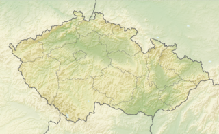
English:
Relief map of the
Czech Republic
Equirectangular projection, N/S stretching 150 %. Geographic limits of the map:
|
| Date | |
| Source |
|
| Author | derivative work Виктор_В |
Licensing
This file is licensed under the
Creative Commons
Attribution-Share Alike 3.0 Unported
license.
-
You are free:
- to share – to copy, distribute and transmit the work
- to remix – to adapt the work
-
Under the following conditions:
- attribution – You must give appropriate credit, provide a link to the license, and indicate if changes were made. You may do so in any reasonable manner, but not in any way that suggests the licensor endorses you or your use.
- share alike – If you remix, transform, or build upon the material, you must distribute your contributions under the same or compatible license as the original.