Republic_of_Venice_1796.png

Size of this preview:
610 × 600 pixels
.
Other resolutions:
244 × 240 pixels
|
488 × 480 pixels
|
781 × 768 pixels
|
1,026 × 1,009 pixels
.
Summary
| Description |
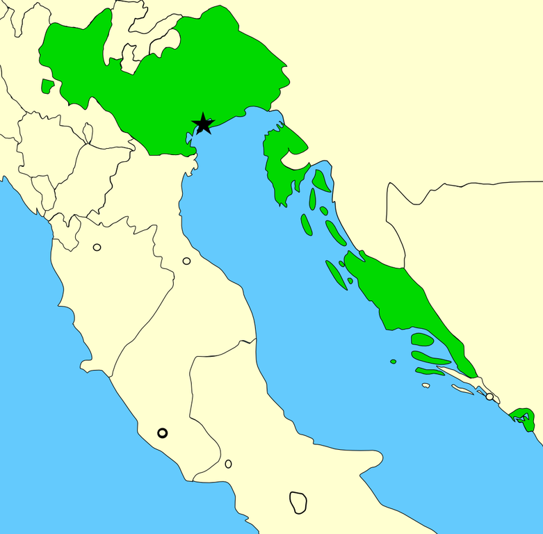
A map showing the territories of the Republic of Venice in the year 1796, before the Napoleonic invasions of that year. Please note that the Venetian-held Ionian Islands are not shown on this map; for a map of these possessions, see Image:Europe 1740.jpg . Created by MapMaster using Image:Italy 1796.png as base. |
| Date | 22 November 2006 (original upload date) |
| Source | No machine-readable source provided. Own work assumed (based on copyright claims). |
| Author | No machine-readable author provided. MapMaster assumed (based on copyright claims). |
Licensing
I, the copyright holder of this work, hereby publish it under the following license:

|
Permission is granted to copy, distribute and/or modify this document under the terms of the GNU Free Documentation License , Version 1.2 or any later version published by the Free Software Foundation ; with no Invariant Sections, no Front-Cover Texts, and no Back-Cover Texts. A copy of the license is included in the section entitled GNU Free Documentation License . |
|
|
This file is licensed under the Creative Commons Attribution-Share Alike 3.0 Unported license. | |
|
||
| This licensing tag was added to this file as part of the GFDL licensing update . |