RepublicanRiver1947.jpg
Size of this preview:
800 × 442 pixels
.
Other resolutions:
320 × 177 pixels
|
640 × 354 pixels
|
1,024 × 566 pixels
|
1,280 × 707 pixels
|
2,560 × 1,415 pixels
|
4,039 × 2,232 pixels
.
Summary
| Description |
English:
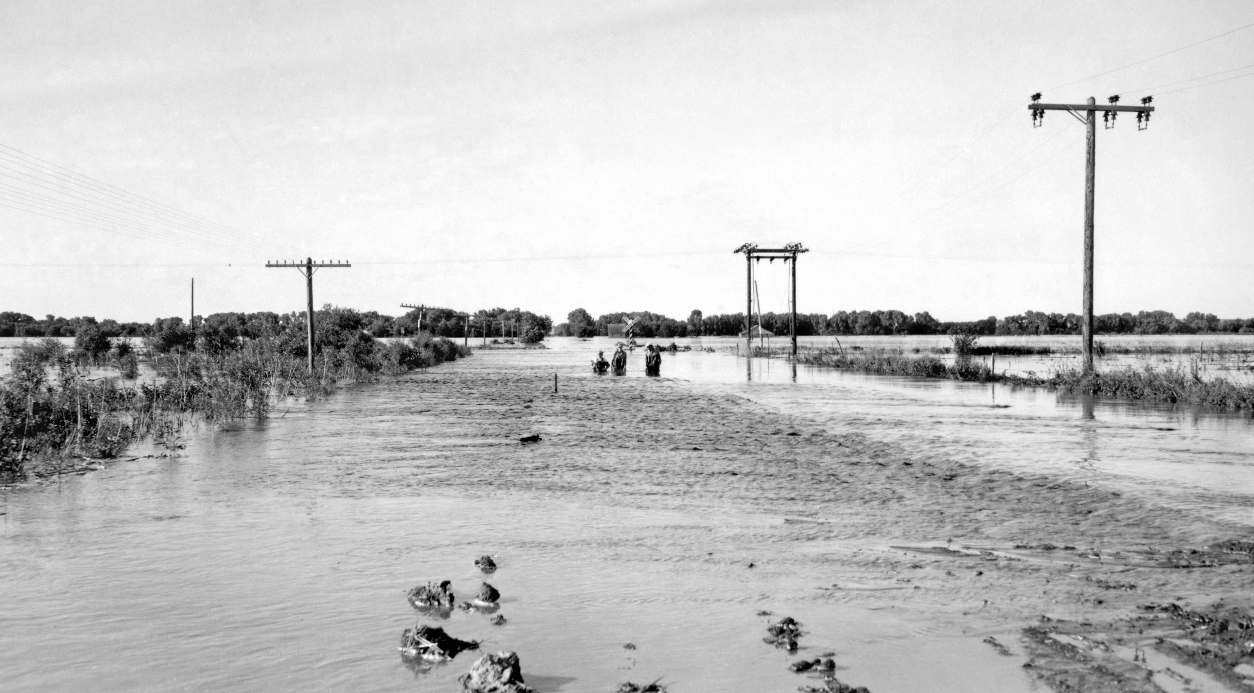
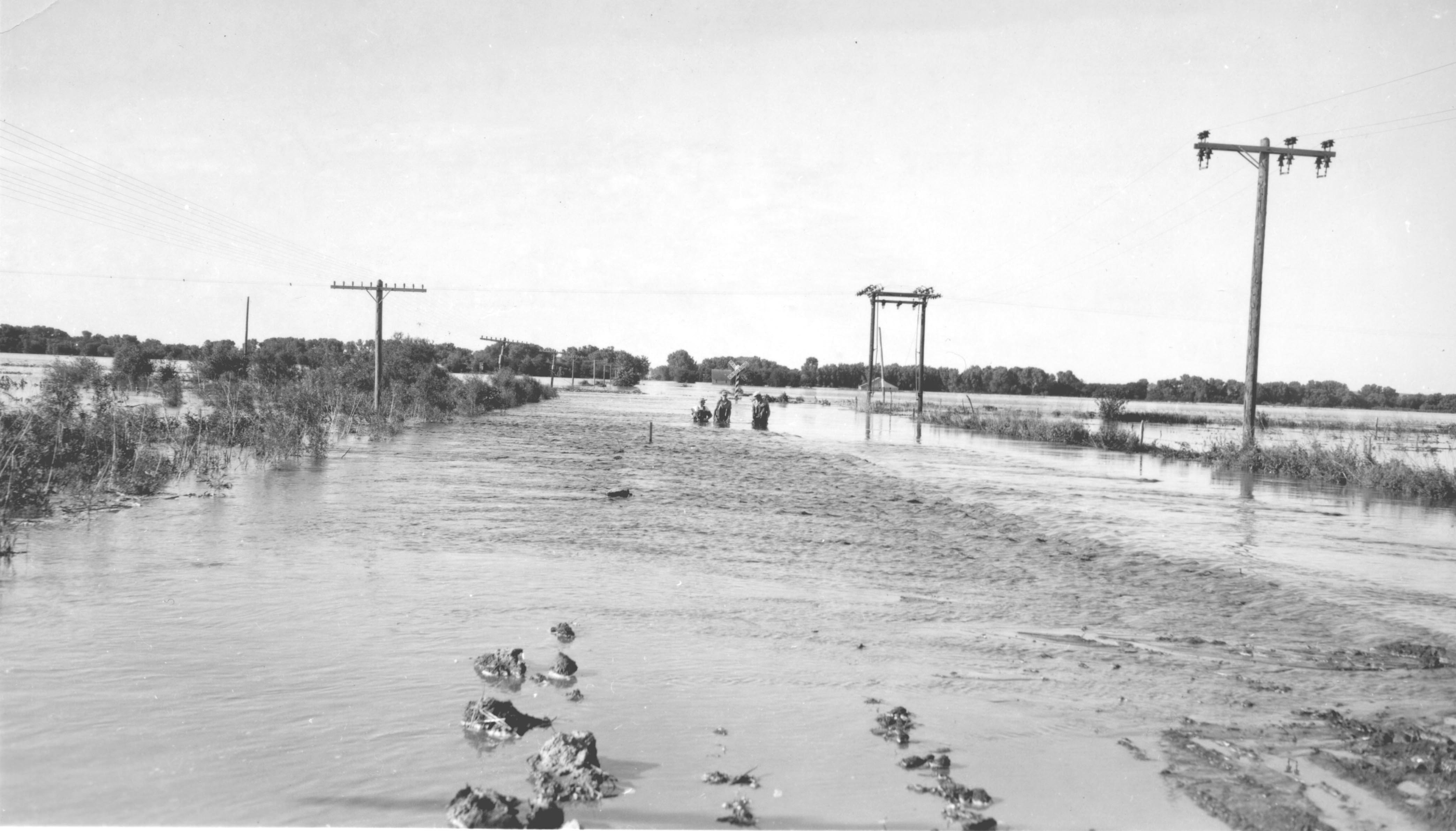
June 24, 1947 flood of the
Republican River
on the border of
Jewell County, Kansas
and
Republic County, Kansas
near
Hardy, Nebraska
and
Webber, Kansas
, just south of Nebraska NE-8 on Kansas 1 Rd/CR-1 bridge over the Republican River. The normal
flood stage
for the river is at the
tree line
in the foreground.
|
| Date | Taken on 24 June 1947 |
| Source | USGS Surface Water Photo Gallery , item 18 09 |
| Author | J.G. Connor (submitted to USGS by Steve Blanchard, OSW) |
Licensing
|
|
This image is in the
public domain
in the United States because it only contains materials that originally came from the
United States Geological Survey
, an agency of the
United States Department of the Interior
. For more information, see
the official USGS copyright policy
.
|
|
Original upload log
The original description page was
here
. All following user names refer to en.wikipedia.
- 2008-09-04 00:03 Suntag 4176×2384× (607863 bytes)